
Spotmap
Treffpunkte Sonntagstraining
- Polizeipräsidium


- Hauptbahnhof
- hinterm Schwabencenter
- Dom
- unterschiedlich, meist spontan
Spots
🏷️
💪
📍
🏷️
(💪
📍)
- ToneArt-Hof (1T)
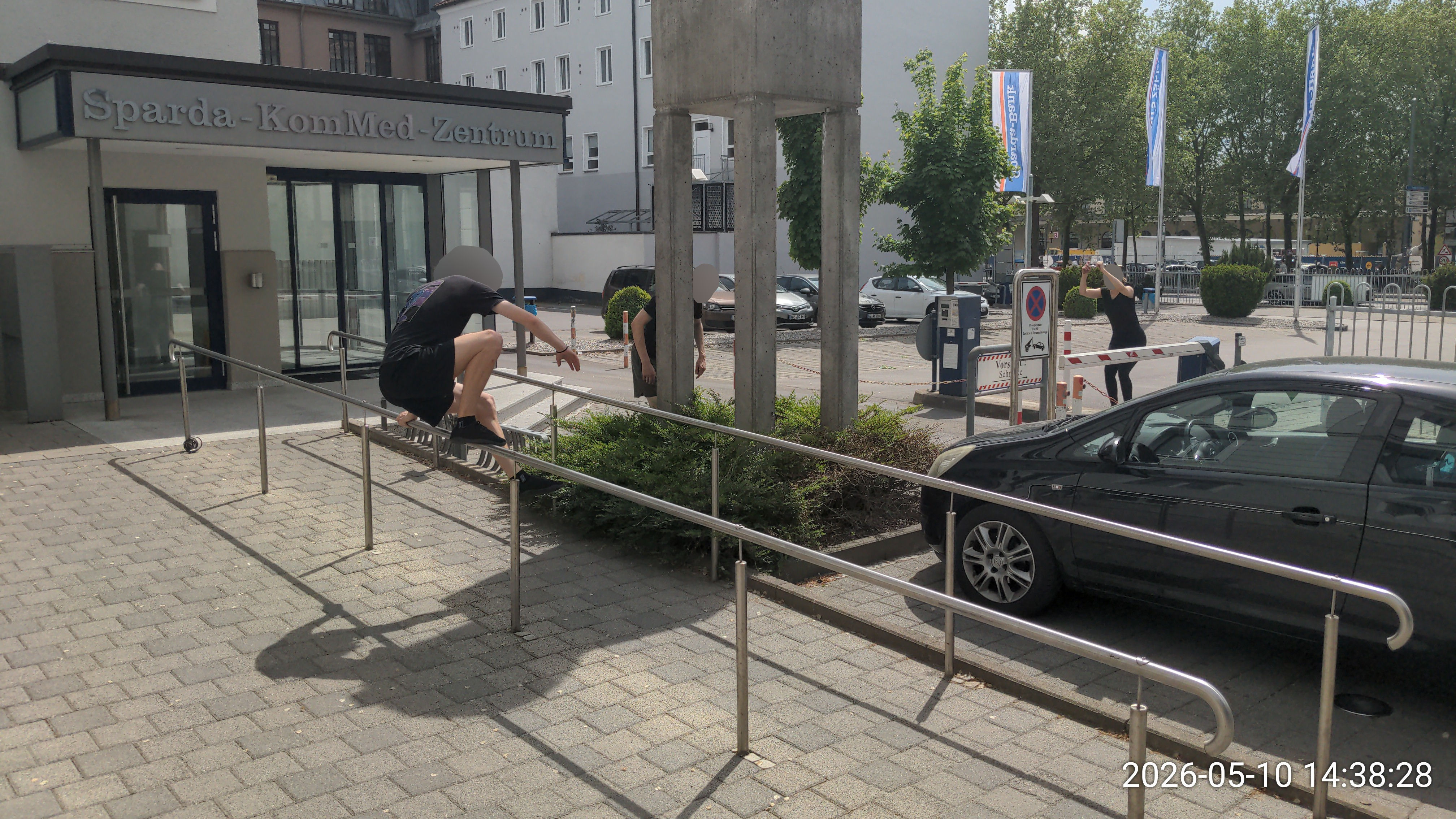
- Sparda-Bank (2S)
- Zauberstangen (3Z)
- Dom Brunnen & Geländer (4D)
- Gögginger Hallenbad Eingangsbereich (5H)
- Sheridanpark Wasserspielplatz (6S)
- City-Galerie Steine (7S)
- Textilmuseum (Schneise) (8A)
- Graffiti-Unterführung (9G)
- Hochschule Kanalbrücke (10H)
- Heilige 63 Steine (11S)
- Gebäude an der Kanustrecke (12K)
- 4FCircle Spielplatz (13C)
- Wertachbrücke Spielplatz (0W)
- ToneArt-Hof Hauswandbeetmauern (1T1)
- ToneArt-Hof Tiefgarageneinfahrt (1T2)
- ToneArt-Hof Ecke (1T3)
- ToneArt-Hof Spielplatz (1T4)
- ToneArt-Hof Steine (1T5)
- ToneArt-Hof rote Mauernkreis (1T6)
- ToneArt-Hof Armsprung auf anderer Seite (1T7)
- kleine Katzen beim ToneArt-Hof Edeka (1T8)
- Sphinxenhof (1S)
- Sphinxenhof Balancestangen (1S1)
- der Ort, an dem Johann belästigt wurde (1J)
- der Ort, an dem Johann belästigt wurde, unten (1J1)
- Gymnasium St Anna (1G)
- miese Präzis (beim Gymnasium) (1G1)
- Müllhäuschenwände (beim Gymnasium) (1G2)
- Betonwürfel beim Manyo (1B)
- Wohnviertel nahe ToneArt-Hof (1V)
- Rosenaustadion (vorne) (1R)
- Rosenaustadion hinten (1R1)
- Steingarten (Rudolf-Diesel-Gedächtnishain) (1W)
- Zwei magische Bäume (1W1)
- Wittelsbacher Park Aufstieg (1W2)
- Sporthalle (1H)
- Sporthalle kleine Betonzylinder (1H1)
- Kongress (Eingang) (1P)
- Kongress Seite (1P1)
- Kirche beim Polizeipräsidium (1K)
- Sparda-Bank Präzis (2S1)
- Sparda-Bank Ecke (2S2)
- Sparda-Bank Wallrunmauern (2S3)
- Hbf Kurve (2K)
- Fassade bei Hbf Kurve (2K1)
- Riegele Wallrun (2K2)
- Finanzamt (2F)
- Finanzamt Mauern (2F1)
- beim Fußarzt (2P)
- Doppelkatze beim Fußarzt (2P1)
- Neue Stadtbibliothek (2B)
- Knochenturm (2T)
- Klinkerberg (2T1)
- Knochenturm, Richtung Stadion (2T2)
- MT Gymnasium Holzsitze (2M)
- MT Gymnasium Ecke (2M1)
- MT Gymnasium Baugerüst (2M2)
- Ausfahrt neben Zauberstangen (3Z1)
- Schwabencenter Parkdeckeck (3P)
- Parkdeckeck klein (3P1)
- Parkdeck Minikatze (3P2)
- Containerdrop (3P3)
- Parkdeck andere Seite (3D)
- Schwabencenter Parkdeck Tiefgarageneinfahrt (3D1)
- Schwabencenter Hinterhof (3H)
- Treppenaufgang beim Hinterhof (3H1)
- vorm Schwabencenter (3V)
- Spielplatz beim Schwabencenter (3S)
- Herrenbachschule (3M)
- Herrenbachschule links (3M1)
- Dom Fassade (4D1)
- Dom Ausgrabungsstätte (4D2)
- Dom Mauer & Spielplatz (4D3)
- Dom Ecke (4D4)
- Dom Bänke (4D5)
- Lange Dommauer (4M)
- Eingang neben langer Dommauer (4M1)
- Liliom Aufgang (4L)
- Liliom Anfängermauer (4L1)
- Liliom Rohr Balance (4L2)
- Liliom Kanal über Kanal (4L3)
- Liliom Eingang (4L4)
- Mauern beim Vincentinum (4V)
- Schwedenstiege (4S)
- neben Leonhardsberg (4B)
- Café neben Leonhardsberg (4B1)
- beim Dreizehn (4B2)
- Hallenbad Turm (5H1)
- Hallenbad hinteres Eck (5H2)
- Hallenbad Seiteneingang (5H3)
- Gögginger Hallenbad Spielplatz (5S)
- Katzenmauern beim Spielplatz (5S1)
- Geländer beim Spielplatz (5S2)
- Park hinterm Hallenbad (5P)
- Parkplätze im Gewerbegebiet (5G)
- Tiefgarageneinfahrt im Gewerbegebiet (5G1)
- Sheridanpark Bäume (6S1)
- Sheridanpark Felsen (6S2)
- altes Gebäde beim Sheridanpark (6S3)
- Reds Kirchspot nahe Sheridan (6S4)
- unter Bgm-Ackermann Brücke (6B)
- Rampe Bgm-Ackermann-Brücke (6B1)
- Wasserdurchlässe unter BgmA-Brücke (6B2)
- Stahlträger bei Holzbachstr/Plärrer (6B3)
- Herz Jesu Kirche Pfersee (6K)
- Katze neben Kirche (6K1)
- Zwischenbereich nahe See (6Z)
- Stadtbergen Sandkasten im Innenhof (6I)
- Stadtbergen Tiefgarage neben Sandkasten im Innenhof (6I1)
- kleine Kletterwand (6W)
- City-Galerie Tiefgarageneinfahrt (7T)
- VHS Eingang (7T1)
- kleiner Präzi auf Metallbalken (7T2)
- VHS Ecke (7T3)
- City-Galerie Brücke (7B)
- City-Galerie Hinterhof (7H)
- City-Galerie Spielplatz (7P)
- Wasserrad nahe City-Galerie (7W)
- Holbeinplatz (7G)
- Wasserkraftwerk (8W)
- Strides bei Gärtnerstraße X Wolframstr (8G)
- Running Pre beim Kanal (8R)
- Schafe (8S)
- Spielplatz neben Schafen (8S1)
- Textilmuseum Metalltreppe beim Parkplatz (8T)
- Garageneinfahrt bei Graffiti-Unterführung (9G1)
- Innenhof (9H)
- Parkplatz neben Innenhof (9H1)
- Bukowina-Institut Hochhaus (9B)
- Bukowina Hochhaus Seite (9B1)
- Uni T-Gebäude (9T)
- Hochschule Parkdeck (10H1)
- Kanal an Haltestelle Hochschule (10H2)
- Hochschule Tiefgarageneinfahrt (10T)
- Präzis und Abgang bei Tiefgarageneinfahrt (10T1)
- Spielplatz Lummerland (10S)
- Rotes Tor Park Brückchen und Aufgang (10R)
- Rotes Tor Park Ecke neben Freilichtbühne (10R1)
- Ausgang nahe Puppenkiste (10R2)
- Schwingerbäume bei den Steinen (11S1)
- Hinter POCO (11P)
- Armsprungstufen hinterm POCO (11P1)
- Bachbrückchen neben Feuerwehr (11B)
- Spielplatz Haunstetten (11K)
- Dachspot (11D)
- Innenhof mit Stangenpre und Rampe neben Spielplatz (12H)
- Garagengap (12G)
- womöglich hier ranzige Schwingerstange mit Hof daneben (12S)
- recht solider Spot noch (12B)
- Ranzige Returns bzw ultra mini roofgap (12R)
- der andere Ranzspot gleich daneben (12R1)
- bei niedrigen wasser geht hier vllt was, hätt bock mal vorbeizuschaun (12L)
- Hochablass (unten) (12A)
- Hochablass (oben) (12A1)
- Steine beim 4FCircle (13C1)
- Schuleingang neben 4FCirlce (13C2)
- Treppenaufgang neben 4FCircle (13C3)
- Kirche (vorne) (13K)
- Kirche hinten (13B)
- Free.Ground Academy (0FG)
- Alter Brunnen beim Plärrer (0P)
- Studentenwohnheim am Lech (0L)
- Modepark beim Studentenwohnheim (0L1)
- Grieslepark Hölzer (0G)
- Grieslepark Calisthenics (0G1)
- Holzstämme nahe Uniklinik (0H)
- Spielplatz nahe Holzsstämme nahe UK (0H1)
- Bunter Quaderhaufen nahe Uniklinik (0H2)
- zwischen OBI und real (0R)
- Katze beim Sport Outlet hinterm OBI (0R1)
- Mauern beim Sport Outlet hinterm OBI (0R2)
- Holzspielplatz im Bismarckviertel (0B)
- Spielplatz nahe Senkelbach und Knochenturmmauer (0S)
- Präzis/Strides des Todes bei TWS (0T)
- Klosterlechfeld Parkourpark (0KP)
- Welden Parkourpark (0WP)
1. Richtung Göggingen
ToneArt-Hof Hauswandbeetmauern
1T1
48.353679, 10.895171
⚠ leise sein
- 💪
- Präzi (weit) (niedrig), Vault
- 📍
- Präzikanten (Mauer) (Stange), Vaultmauer, Vordach
- 🎁
- Orkanpräzi, Stufenpräzis, viele verschiedene hüfthohe Präzis
ToneArt-Hof Tiefgarageneinfahrt
1T2
48.353406, 10.894621
- 💪
- Wallrun, Vault
- 📍
- Wallrunmauer (aufsteigend), Vaultmauer, Tiefgarageneinfahrt, Präzikanten
- 🎁
- Wallrun auf dünnem Anlauf, schiefe Katze
ToneArt-Hof Ecke
1T3
48.353240, 10.896018
- 💪
- Präzi (running), Drop (🦵), Armsprung, Return, Schwinger (Baum)
- 📍
- Präzikanten, Baum (schwingen), Fassade, Stufen mit Wand
- 🎁
- Katze an Baum
ToneArt-Hof Spielplatz
1T4
48.354973, 10.895584
⚠ Kinder
- 💪
- Vault
- 📍
- Geländer (dick), Kletterpyramide
- 🎁
- Drop auf Kletterpyramidenfuß, Eckgeländer aus Holz
ToneArt-Hof Steine
1T5
48.354064, 10.897104
- 💪
- Präzi (niedrig), Drop, Workout
- 📍
- Präzikanten (Mauer) (Steine)
- 🎁
- alle Präzis sticken
ToneArt-Hof rote Mauernkreis
1T6
48.354331, 10.896026
- 💪
- Präzi (weit), Wallrun (hoch), Klettern
- 📍
- Präzikanten (Steine), Wallrunmauer (schief), Fassade
ToneArt-Hof Armsprung auf anderer Seite
1T7
48.353100, 10.895203
- 💪
- Armsprung, Balance
- 📍
- Fassade, Geländer (auf Wand), Gap
- 🎁
- Armsprung an Fassade und runter zurück
kleine Katzen beim ToneArt-Hof Edeka
1T8
48.353176, 10.894178
⚠ Verkehr (Autos im Anlauf)
- 💪
- Katze (nach oben)
- 📍
- Geländer (wack)
- 🎁
- Katzen hoch (ungefährlich)
Sphinxenhof
1S
48.352068, 10.900452
- 💪
- Wallrun, Präzi
- 📍
- Wallrunmauer, Präzikanten, Schaukel
Sphinxenhof Balancestangen
1S1
48.351649, 10.900197
- 💪
- Balance, Rundgang, Wallrun (klein)
- 📍
- Balancestange, Wallrunmauer
- 🎁
- lange Balance, Rundgänge rund um Hof
der Ort, an dem Johann belästigt wurde
1J
48.350481, 10.896885
- 💪
- Präzi, Armsprung
- 📍
- Präzikanten, Baum (schwingen)
- 🎁
- Kicker-Armsprung an Säule
der Ort, an dem Johann belästigt wurde, unten
1J1
48.350686, 10.897212
- 💪
- Vault, Präzi (mittelhoch), Wallpop, Balance
- 📍
- Geländer (+1), Präzikanten (Mauer)
Gymnasium St Anna
1G
48.354741, 10.887328
⚠ Wochenende-only
- 💪
- Vault
- 📍
- Vaultmauer
miese Präzis (beim Gymnasium)
1G1
48.355085, 10.888234
⚠ Wochenende-only, eingeschränkter Zugang
- 💪
- Präzi, Drop
- 📍
- Präzikanten
Müllhäuschenwände (beim Gymnasium)
1G2
48.354288, 10.889082
⚠ Wochenende-only
- 💪
- Präzi (mittelhoch)
- 📍
- Präzikanten (Mauer)
Betonwürfel beim Manyo
1B
48.353431, 10.891576
- 💪
- Präzi (running)
- 📍
- Präzikanten (verschiebbar)
Wohnviertel nahe ToneArt-Hof
1V
48.351907, 10.889999
- 💪
- Präzi, Armsprung
Rosenaustadion (vorne)
1R
48.355367, 10.877803
⚠ Glasscherben
- 💪
- Vault, Präzi (weit), Wallrun (klein) (Überhang), Polio, Dynamo, Balance
- 📍
- Geländer (hoch), Präzikanten (Stange), Wallrunmauer, Pole, Vordach
- 🎁
- ∞ Lazys, Polio-Traversal, Vordachfelge und -dynamos
Rosenaustadion hinten
1R1
48.356675, 10.875652
- 💪
- Vault, Präzi, Balance
- 📍
- Geländer (hoch), Präzikanten (Stange)
Steingarten (Rudolf-Diesel-Gedächtnishain)
1W
48.357566, 10.880086
- 💪
- Präzi (weit) (wack), Armsprung, Katze (Doppel), Drop (🦵) (🥵)
- 📍
- Präzikanten (Felsen)
- 🎁
- Überhang-Armsprung
Zwei magische Bäume
1W1
48.359464, 10.882993
⚠ ein Baum RIP
- 💪
- Präzi, Wallrun, Klettern
- 📍
- Baum (klettern), Präzikanten (Baum), Bank
Wittelsbacher Park Aufstieg
1W2
48.360580, 10.883841
- 💪
- Workout
- 📍
- Steigung
Sporthalle
1H
48.356367, 10.880574
⚠ leise sein
- 💪
- Vault
- 📍
- Geländer (nahe Wand)
- 🎁
- Minikatze zur Wand, Lazy mit Wand
Sporthalle kleine Betonzylinder
1H1
48.356263, 10.881086
- 💪
- Strides, Präzi
- 📍
- Präzikanten (verschiebbar)
- 🎁
- ∞ Strides
Kongress (Eingang)
1P
48.358924, 10.887961
- 💪
- Präzi
- 📍
- Präzikanten, Fassade
Kongress Seite
1P1
48.359666, 10.887644
- 💪
- Armsprung
- 📍
- Stufen mit Wand
Kirche beim Polizeipräsidium
1K
48.357677, 10.884297
- 💪
- Vault, Präzi
- 📍
- Vaultmauer, Präzikanten
- 🎁
- Bocksprungkatzen an Betonpfosten
2. Innenstadt
Sparda-Bank Präzis
2S1
48.366680, 10.887186
⚠ Verkehr (Autoparkplätze, werktags)
- 💪
- Präzi (weit), Strides
- 📍
- Präzikanten
Sparda-Bank Ecke
2S2
48.366541, 10.887768
⚠ eingeschränkter Zugang
- 💪
- Drop (🦵) (🥵), Armsprung, Wallpop, Return (weit) (zu Armsprung)
- 📍
- Präzikanten (Mauer), Wallrunmauer (wack)
- 🎁
- Drop von Mauer zu Mauer
Sparda-Bank Wallrunmauern
2S3
48.366518, 10.887529
- 💪
- Wallrun
- 📍
- Wallrunmauer
- 🎁
- Wallrun auf Mauer
Hbf Kurve
2K
48.367772, 10.886148
⚠ überwuchert (Blühwiese?), Verkehr (Fahrräder, Autos)
- 💪
- Vault, Armsprung (klein) (running), Katze (Stange) (zu Armsprung), Präzi (niedrig), Tic Tac, Dynamo
- 📍
- Geländer (+1) (auf Wand), Präzikanten (Stange) (Stufen)
- 🎁
- Präzis auf Stangen an Enden & von Mauer, verschiedene Armsprünge an Mauer+Geländer
Fassade bei Hbf Kurve
2K1
48.367462, 10.885681
- 💪
- Strides, Präzi (niedrig), Balance
- 📍
- Präzikanten (Mauer), Geländer, Fassade
Riegele Wallrun
2K2
48.367924, 10.885831
- 💪
- Wallrun
- 📍
- Wallrunmauer (aufsteigend)
Finanzamt
2F
48.367457, 10.890791
⚠ Wochenende-only
- 💪
- Vault, Katze (Stange) (zu Armsprung), Armsprung (klein), Dynamo, Präzi (niedrig), Balance
- 📍
- Geländer (hoch) (nahe Wand) (wack), Präzikanten (Stange) (Stufen)
- 🎁
- kleiner Cat Drop Rail Pre, wacke Bocksprünge über mittelhohe Pfosten
Finanzamt Mauern
2F1
48.367507, 10.891080
⚠ Wochenende-only?
- 💪
- Wallrun (klein), Wallpop, Armsprung (Kicker), Dynamo (running), Präzi
- 📍
- Wallrunmauer (grippy), Präzikanten (Steine)
- 🎁
- Running Dynamo von Mauer zum Torbogen, Kicker-Armsprung von Stange zum Fensterbrett
beim Fußarzt
2P
48.368756, 10.886998
- 💪
- Vault, Katze, Wallrun (klein), Balance
- 📍
- Vaultmauer (hoch), Wallrunmauer (rutschig), Präzikanten
- 🎁
- Katze und Tic Tac mit Baum, Vaults auf orthogonalen Bordstein
Doppelkatze beim Fußarzt
2P1
48.368806, 10.886392
- 💪
- Katze (Doppel)
- 📍
- Block, Vaultmauer
- 🎁
- Doppelkatze lernen (keine Lücke)
Neue Stadtbibliothek
2B
48.369009, 10.895109
⚠ Verkehr (Fuß, werktags)
- 💪
- Wallpop, Armsprung (klein) (running) (wack) (weit), Präzi (niedrig), Katze (zu Armsprung) (Flug), Vault
- 📍
- Wallrunmauer (schief) (grippy), Präzikanten (Mauer) (Stufen), Block, Vaultmauer (wack) (hoch), Geländer (wack)
- 🎁
- Wallrun ohne Hände, Kai-Challenge, Running Armsprung aus Mitte & von rotem Boden & von Stufen, Katze nach unten auf Fahrradbügel (Cat Drop Rail Pre wack)
Knochenturm
2T
48.372241, 10.887848
⚠ Glasscherben
- 💪
- Wallrun (klein) (hoch), Präzi (running) (wack) (mittelhoch), Katze (Doppel) (Flug), Drop (🦵🦵) (🥵), Return (kurz) (zu Armsprung) (weit) (running), Tic Tac
- 📍
- Wallrunmauer (aufsteigend), Baum (klettern), Präzikanten (Mauer) (Baum) (Stufen), Block, Steigung
- 🎁
- Wallrun am Baum, Flug-/Doppelkatze, Running Pre zum Baum, Running Return vom Turm zur kleinen Mauer, Präzis/Drops auf Bankfüße
Klinkerberg
2T1
48.371127, 10.888205
⚠ Verkehr (Autos)
- 💪
- Armsprung (klein) (runter) (Kicker), Präzi (wack) (niedrig), Klettern, Wallrun, Return?
- 📍
- Präzikanten (Stange) (Mauer) (Stufen), Geländer (wack) (auf Wand), Wallrunmauer (rutschig?)
- 🎁
- Armsprünge bei hinteren Stufen, wacke Präzis auf kleine Stangen, Kicker-Armsprünge mit Anlauf von Straße
Knochenturm, Richtung Stadion
2T2
48.373417, 10.887349
- 💪
- Präzi, Balance, Vault, Klettern, Workout
- 📍
- Präzikanten (Stufen), Geländer, Steigung
MT Gymnasium Holzsitze
2M
48.369141, 10.889256
⚠ Wochenende-only
- 💪
- Präzi (weit) (running), Drop (🦵), Strides, Wallrun (klein), Schwinger (Baum), Return (running) (kurz)
- 📍
- Präzikanten (Holz) (verschiebbar), Baum (schwingen), Wallrunmauer (rutschig), Vordach, Tischtennisplatte
- 🎁
- Vordachfelge zu Zaunarmsprung, kleine Schwinger am Baum
MT Gymnasium Ecke
2M1
48.368948, 10.890007
⚠ Wochenende-only
- 💪
- Vault, Armsprung, Präzi (mittelhoch), Return (zu Stange)
- 📍
- Geländer (wack), Fassade, Präzikanten (Mauer)
- 🎁
- wacker running Kicker-Pre auf Würfel, Präzi beim Treppenaufgang
MT Gymnasium Baugerüst
2M2
48.369590, 10.889675
⚠ Wochenende-only
- 💪
- Schwinger (Stange) (Pole), Präzi, Balance, Polio, Descend, Workout
- 📍
- Schwingerstange, Pole (schwingbar), Präzikanten (Stange)
3. Schwabencenter & Umgebung
Zauberstangen
3Z
48.356850, 10.926523
⚠ Eichenprozessionsspinner
- 💪
- Vault, Balance, Präzi (niedrig) (running), Strides, Armsprung (wack)
- 📍
- Geländer (+1), Präzikanten (Stange), Steigung, Baum
- 🎁
- Stangenpräzi für Anfänger, Armsprung zum Baum
Ausfahrt neben Zauberstangen
3Z1
48.357126, 10.926048
- 💪
- Präzi (running) (weit), Vault, Wallrun (klein), Wallpop
- 📍
- Vaultmauer (niedrig) (wack), Präzikanten (Mauer), Tiefgarageneinfahrt, Wallrunmauer (aufsteigend) (rutschig?)
- 🎁
- Running Pre über Einfahrt, weiter/running Pre über Minihecke
Schwabencenter Parkdeckeck
3P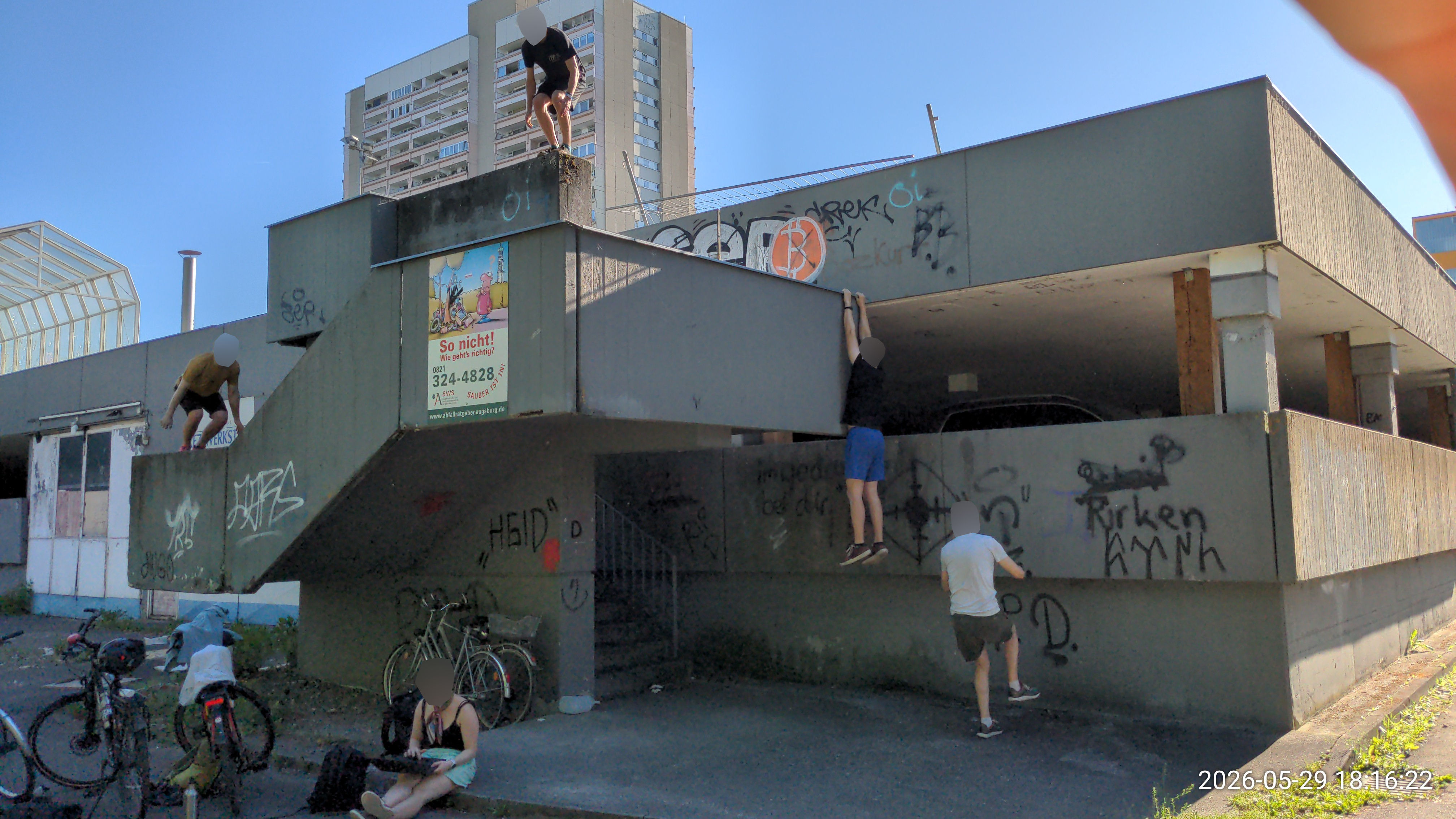
48.356680, 10.926236
⚠ Glasscherben
- 💪
- Wallrun (klein), Armsprung, Präzi (weit) (wack) (mittelhoch), Dynamo (running), Katze (zu Armsprung) (weit), Drop (🦵) (🥵🥵🥵), Klettern, Descend
- 📍
- Wallrunmauer (schief) (rutschig) (aufsteigend), Stufen mit Wand, Präzikanten (Stufen) (Mauer), Vaultmauer (wack), Fassade, Gap
- 🎁
- Katze zum Mittelstück, Wallrunning Dynamo, hohe Stufenarmsprünge und -präzis, Drop vom Mittelstück, Descend+Ascend
Parkdeckeck klein
3P1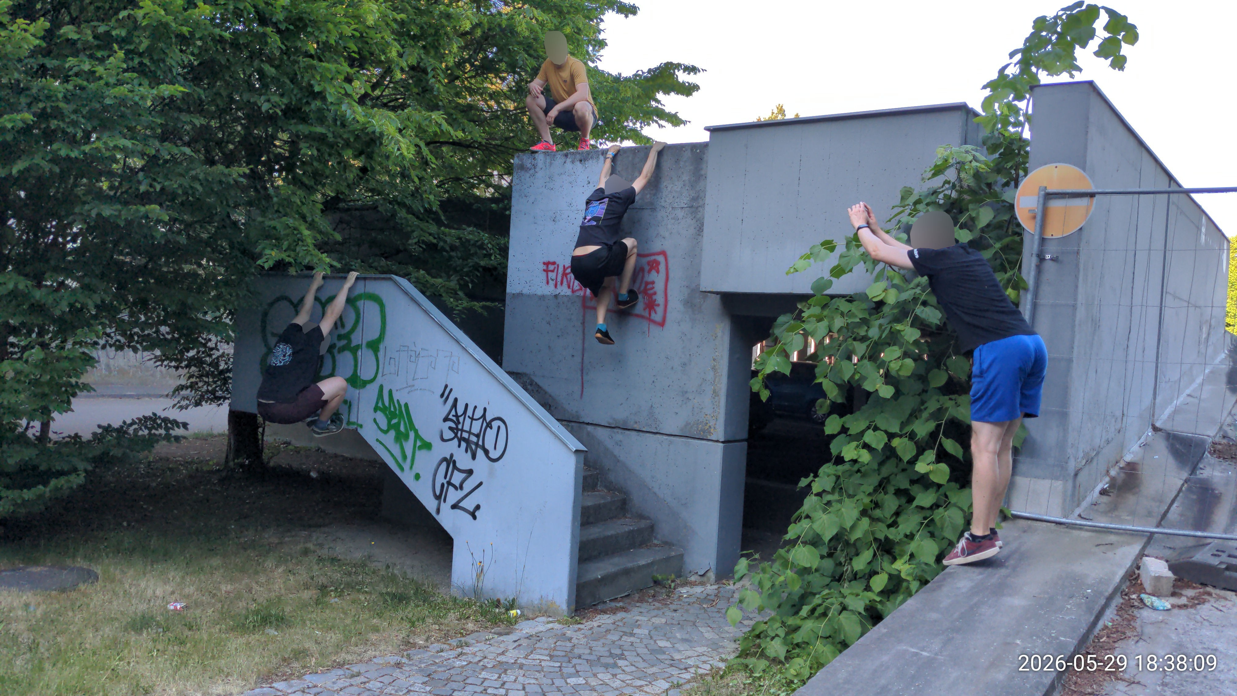
48.356638, 10.925168
⚠ Äste ragen rein (entfernbar)
- 💪
- Armsprung, Präzi (weit) (wack) (mittelhoch), Drop (🦵) (🥵)
- 📍
- Präzikanten (Mauer), Vaultmauer (wack)
- 🎁
- Drop vom Mittelstück (ohne Todesdrop)
Parkdeck Minikatze
3P2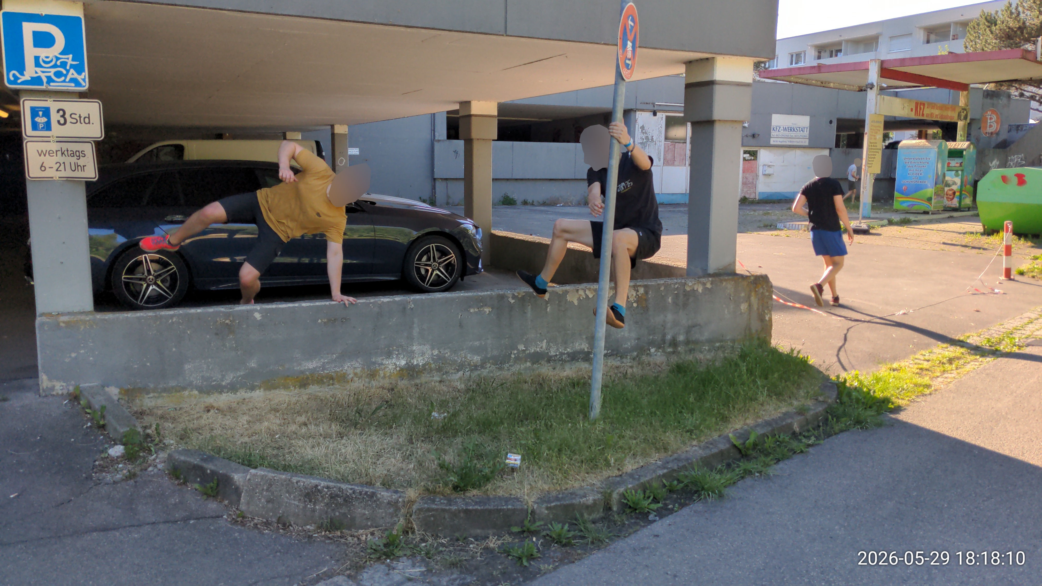
48.355836, 10.928285
⚠ hohes Gras
- 💪
- Katze, Schwinger (Pole)
- 📍
- Vaultmauer (niedrig), Pole (schwingbar), Präzikanten
- 🎁
- Katze -> Poleschwinger zur Minimauer
Containerdrop
3P3
48.355693, 10.926869
⚠ Container ist selten da
- 💪
- Drop (🦵🦵) (🥵), Vault
- 📍
- Container, Gap, Geländer (auf Wand), Präzikanten
- 🎁
- Drop vom Container zu Steinen
Parkdeck andere Seite
3D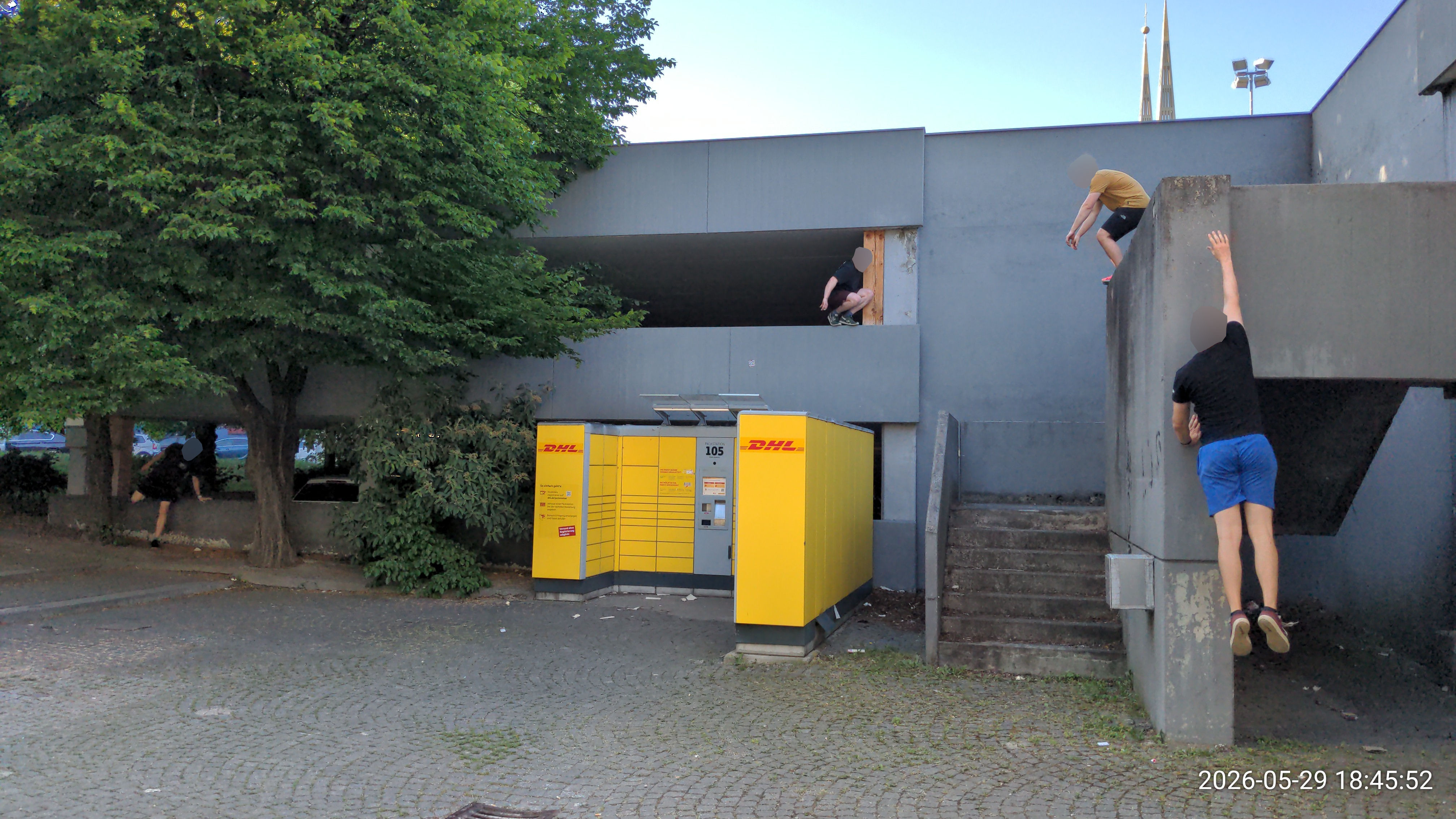
48.355942, 10.925243
⚠ Glasscherben
- 💪
- Descend, Präzi (wack), Drop (🦵) (🥵🥵) (🦵🦵) (🥵🥵🥵) (🦵🦵🦵), Strides, Vault, Katze, Armsprung (running), Klettern
- 📍
- Wallrunmauer, Vaultmauer (niedrig), Präzikanten (Mauer), Stufen mit Wand, Steigung
- 🎁
- Descends+Ascends (für Anfänger), Drops auf Treppenwände, Katze gegen Wand, Minisprung ganz oben ins Hängen, kleiner Präzi unter Decke, running Armsprung, hoher Wallrun
Schwabencenter Parkdeck Tiefgarageneinfahrt
3D1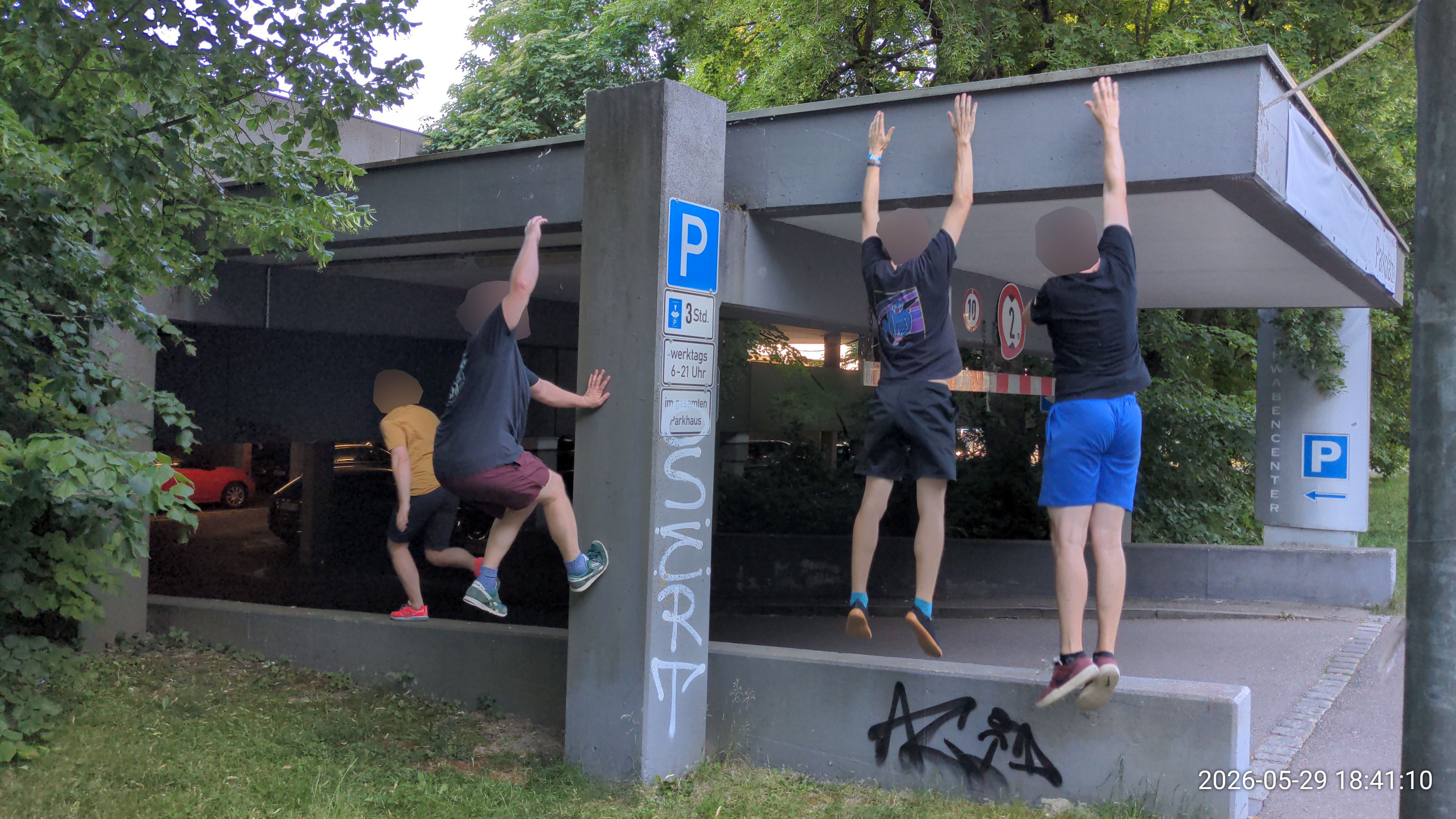
48.356345, 10.925096
- 💪
- Klettern, Descend, Wallrun, Vault, Armsprung (runter), Return (zu Armsprung)
- 📍
- Fassade, Wallrunmauer (rutschig), Vaultmauer (niedrig), Tiefgarageneinfahrt
- 🎁
- Ascend-Sprüngchen, trügerisch rutschiger Wallrun, Armsprung+Returns zwischen Säule und Wand
Schwabencenter Hinterhof
3H
48.356267, 10.923977
- 💪
- Präzi (weit) (eng) (niedrig), Vault, Katze, Wallrun, Klettern
- 📍
- Präzikanten (Mauer), Vaultmauer (hoch), Wallrunmauer (rutschig) (aufsteigend), Baum (klettern), Steigung
- 🎁
- rückwärts runter felgen an Wand, Präzi auf schmale Wand, Katze zu Baum (Armsprung)
Treppenaufgang beim Hinterhof
3H1
48.355795, 10.922553
- 💪
- Präzi (mittelhoch)
- 📍
- Präzikanten (Mauer)
- 🎁
- Präzi rüber
vorm Schwabencenter
3V
48.355319, 10.926107
- 💪
- Armsprung (runter) (running), Return (kurz) (zu Armsprung), Präzi (wack) (mittelhoch), Vault, Wallrun (klein)
- 📍
- Stufen mit Wand (groß), Präzikanten (Stange) (Mauer), Balancestange, Vaultmauer
- 🎁
- Pole-Strides, Präzis auf dünnen Stangen
Spielplatz beim Schwabencenter
3S
48.357297, 10.928505
- 💪
- Schwinger (Baum), Präzi (weit) (running) (eng) (wack), Strides
- 📍
- Baum (schwingen), Baumstammhölzer, Spielplatz, Bank
- 🎁
- verschiedene Baumschwinger
Herrenbachschule
3M
48.357484, 10.930173
⚠ Wochenende-only, leise sein
- 💪
- Präzi (weit) (niedrig), Vault, Katze (weit)
- 📍
- Präzikanten (Mauer) (Stange) (verschiebbar), Vaultmauer, Geländer (+1), Baum (schwingen)
- 🎁
- Rolle über Betonblock, tiefe Katze zwischen Mauern
Herrenbachschule links
3M1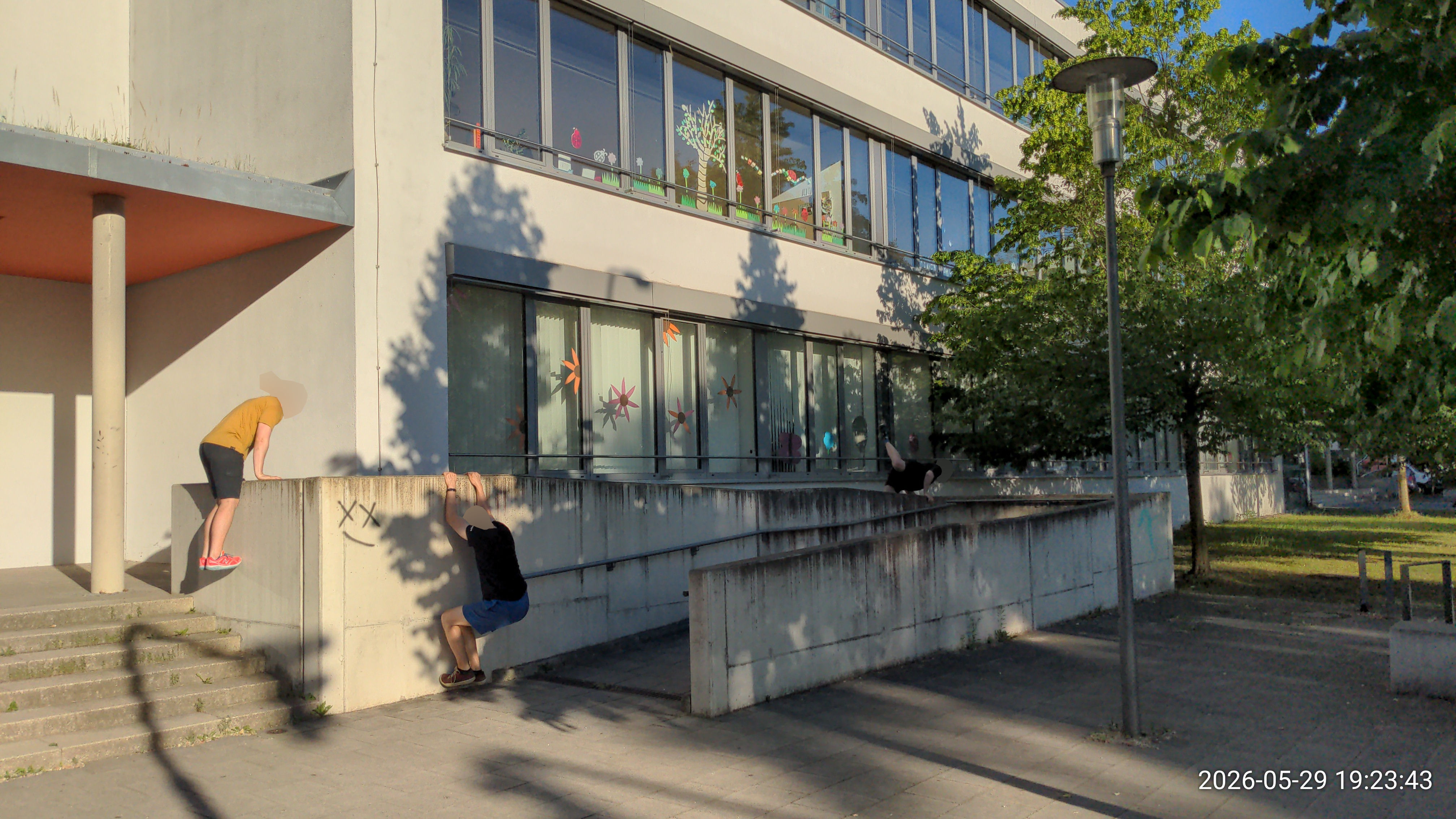
48.358053, 10.930206
⚠ Wochenende-only, leise sein (Hausmeister wohnt daneben?)
- 💪
- Präzi (niedrig), Katze (zu Armsprung?), Wallpop?, Return? (kurz)
- 📍
- Präzikanten (Stufen) (Mauer), Vaultmauer
4. Altstadt
Dom Brunnen & Geländer
4D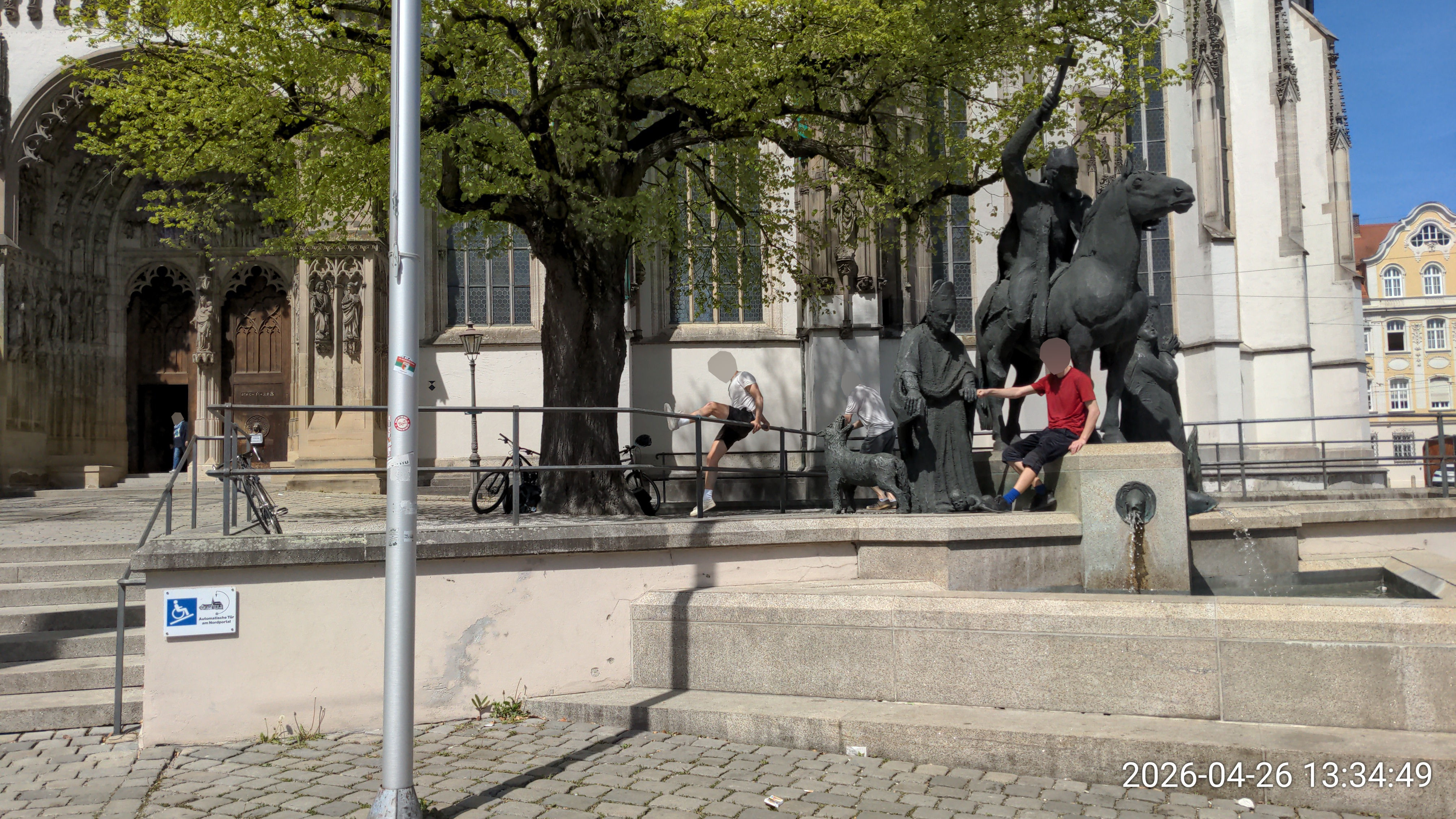
48.372466, 10.897118
⚠ Brunnen im Winter verdeckt, Geländer teil-/zeitweise durch Blumenkästen blockiert, Umknick-Wurzeln unter Kies!
- 💪
- Vault, Balance, Präzi (weit) (niedrig), Drop (🦵) (🥵), Katze (Stange) (Flug) (wack), Workout
- 📍
- Geländer (+1) (wack) (auf Wand), Präzikanten (Stufen) (Stange), Wasser
- 🎁
- Sprünge (über Fisch) & Katze (von Pferdepodest) übers Wasser, lange Balancestrecke, Flugkatze vom Pferdepodest, Stangenkatze zum Pferdepodest, Durchbruch von Stufen aus
Dom Fassade
4D1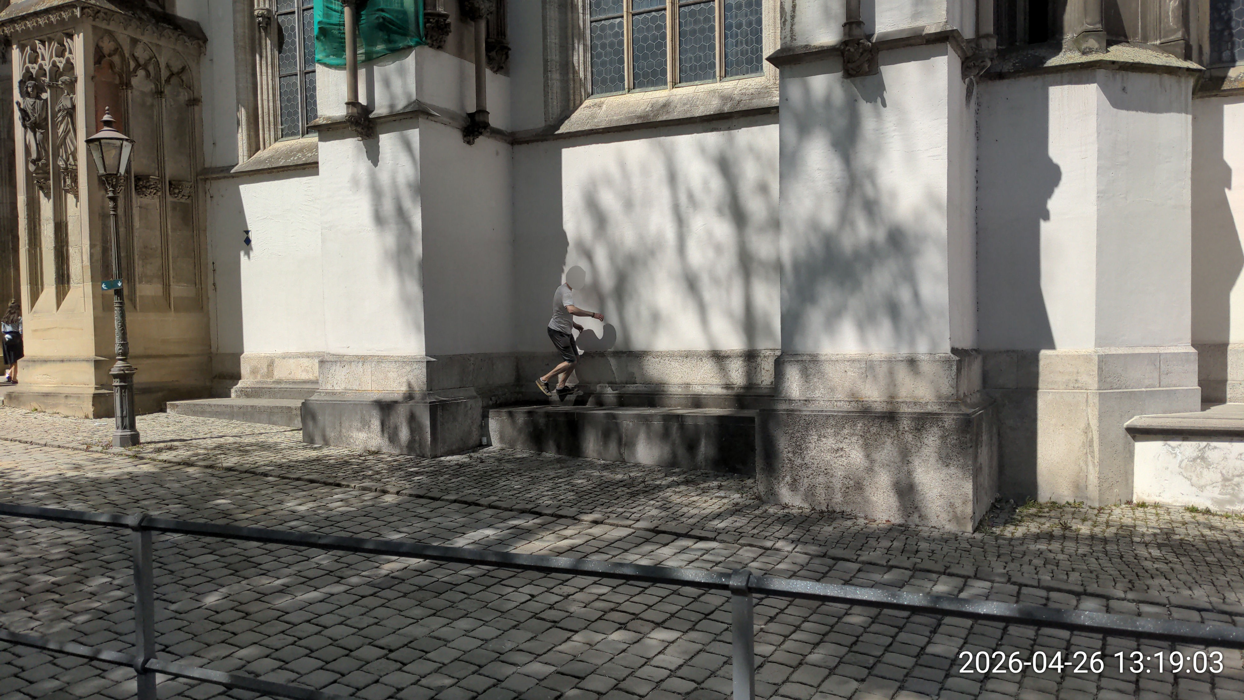
48.372651, 10.897075
- 💪
- Klettern, Präzi (weit) (wack) (niedrig), Armsprung (klein)
- 📍
- Fassade, Block, Präzikanten (Mauer)
- 🎁
- Präzis am Eck, Präzis mit Laterne, schnelles Fassadenklettern, hohe Katzen leveln
Dom Ausgrabungsstätte
4D2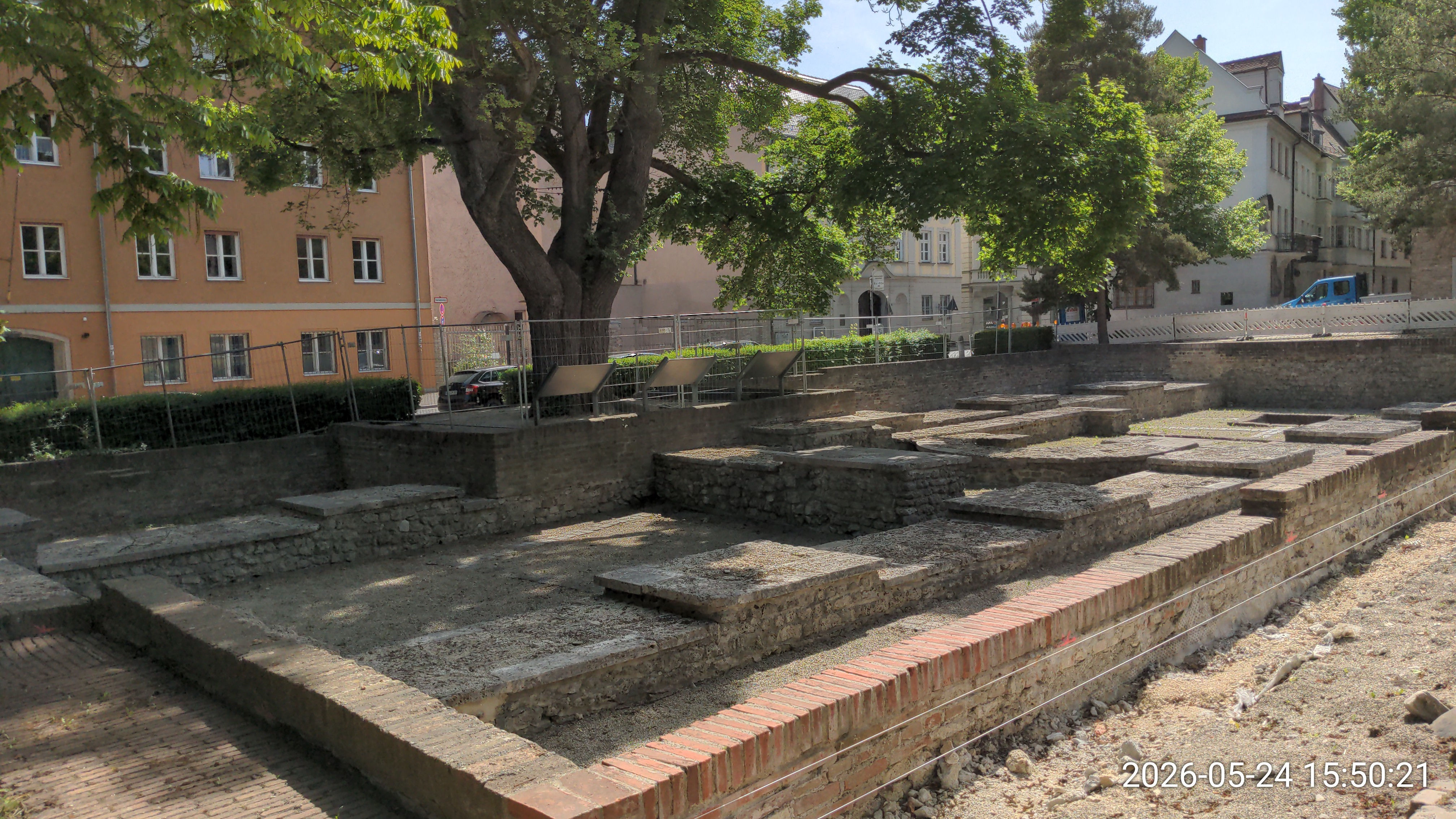
48.372118, 10.896624
⚠ Baustelle, seit ~2022 kein Zugang
- 💪
- Präzi (running) (weit) (niedrig), Drop (🦵) (🦵🦵🦵) (🥵), Armsprung (running), Katze (Flug) (Doppel), Return, Wallpop
- 📍
- Präzikanten, Block
- 🎁
- mittlerer Drop, Katzen über Block, running Armsprung zum Rand, wacke Challenges an mittleren Infotafeln+Baum, großer Drop vom Rand
Dom Mauer & Spielplatz
4D3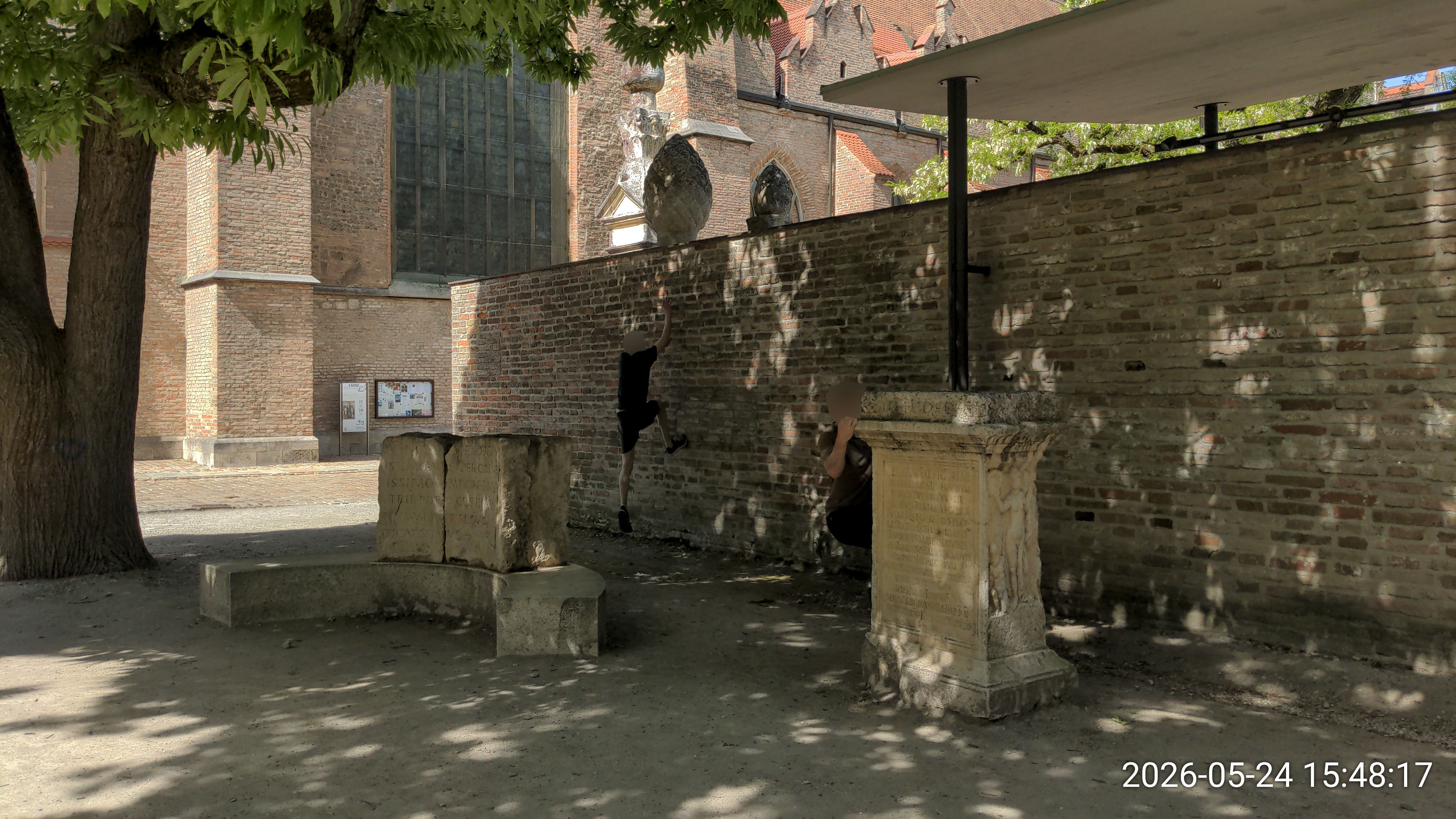
48.372221, 10.896152
- 💪
- Wallrun (hoch), Präzi (mittelhoch) (weit), Armsprung (Kicker) (klein), Drop (🦵🦵) (🥵) (🦵🦵🦵) (🥵🥵), Klettern
- 📍
- Wallrunmauer (aufsteigend), Präzikanten (Mauer), Spielplatz, Bank, Baum (schief)
- 🎁
- Kletterchallenges an dicker Säule, running Kicker-Armsprung zur Wand, höchster Wallrun, dummer Drop vom Dach
Dom Ecke
4D4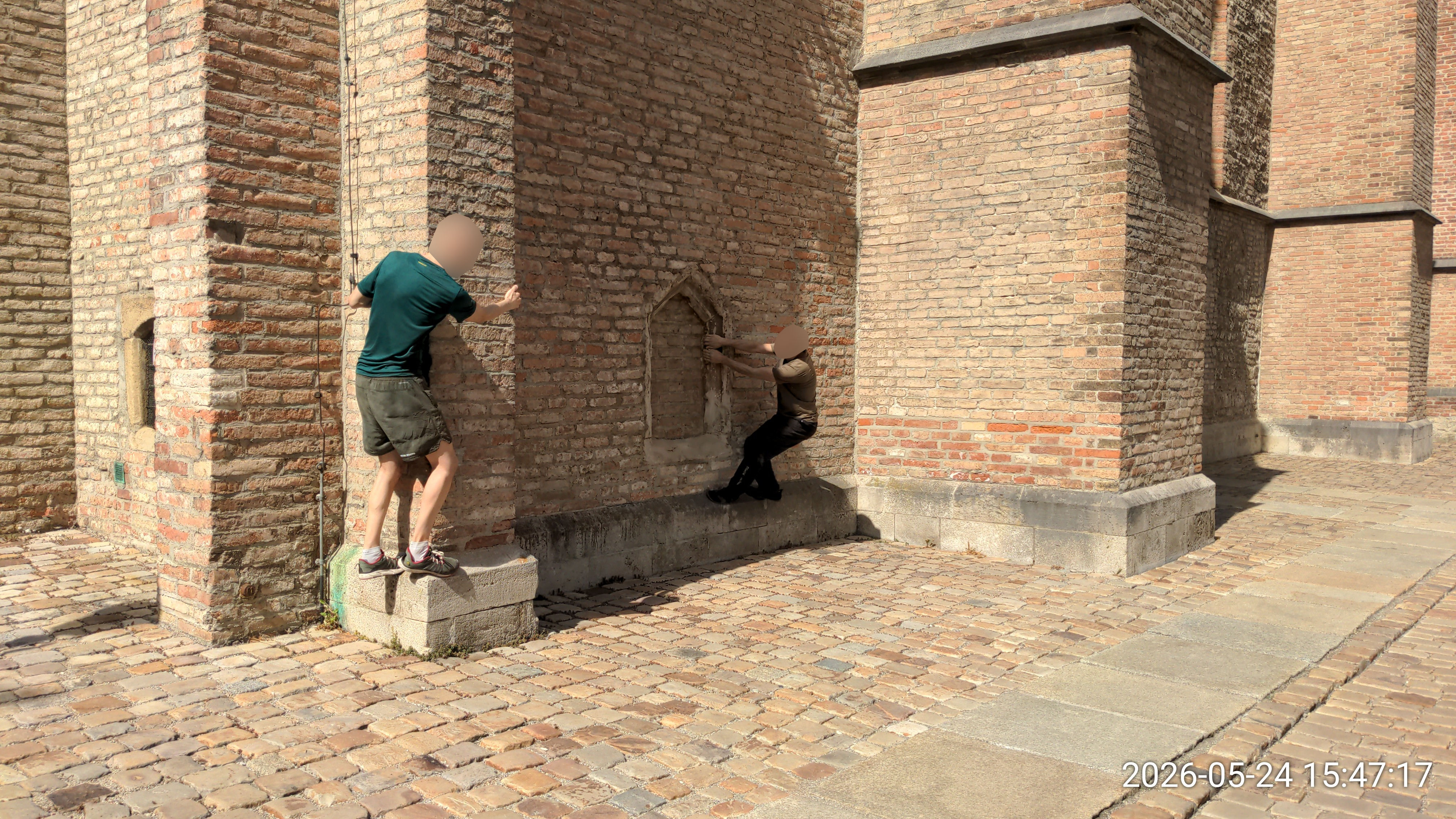
48.372426, 10.895986
- 💪
- Klettern, Rundgang
- 📍
- Fassade
Dom Bänke
4D5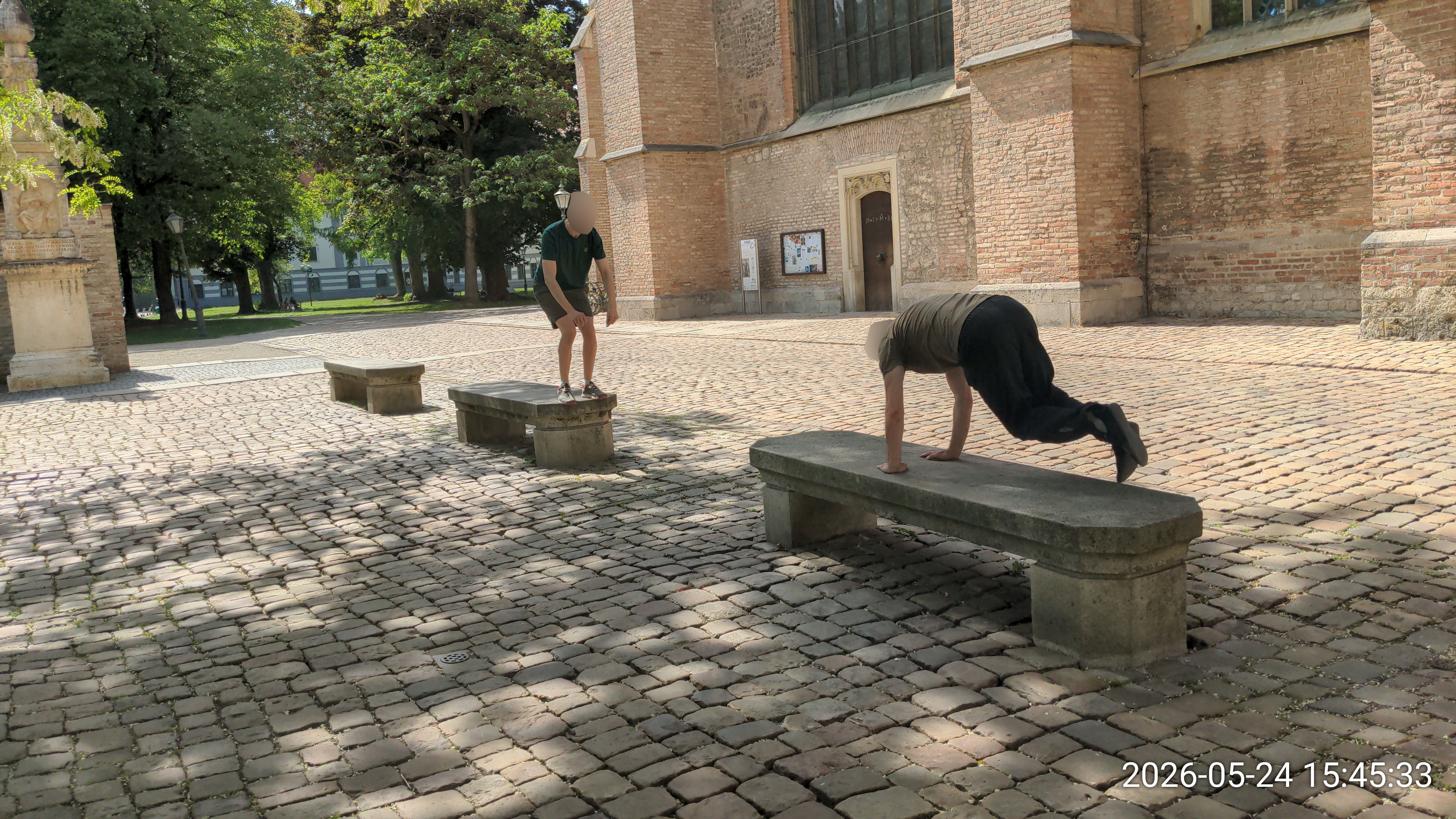
48.372350, 10.896477
⚠ besetzt bei gutem Wetter
- 💪
- Präzi (weit) (niedrig), Vault
- 📍
- Bank, Präzikanten
Lange Dommauer
4M
48.370974, 10.894398
- 💪
- Wallrun (hoch) (klein), Armsprung, Wallpop, Return (kurz), Präzi (mittelhoch) (hoch), Katze, Drop (🦵), Workout
- 📍
- Wallrunmauer (grippy) (aufsteigend), Präzikanten (Mauer) (Stufen)
- 🎁
- Katze Drop
Eingang neben langer Dommauer
4M1
48.371076, 10.894795
- 💪
- Tic Tac, Präzi, Return (running)
- 📍
- Präzikanten (Stufen)
Liliom Aufgang
4L
48.371956, 10.900125
⚠ Büsche blockieren untere Armsprünge
- 💪
- Armsprung, Balance, Vault, Dynamo, Return (weit) (zu Stange), Workout
- 📍
- Geländer (+2) (dick) (hoch) (auf Wand), Präzikanten (Stufen), Fassade, Steigung
- 🎁
- Armsprung und Dynamo hoch, Splat Armsprung (durch Büsche blockiert), kranker Return
Liliom Anfängermauer
4L1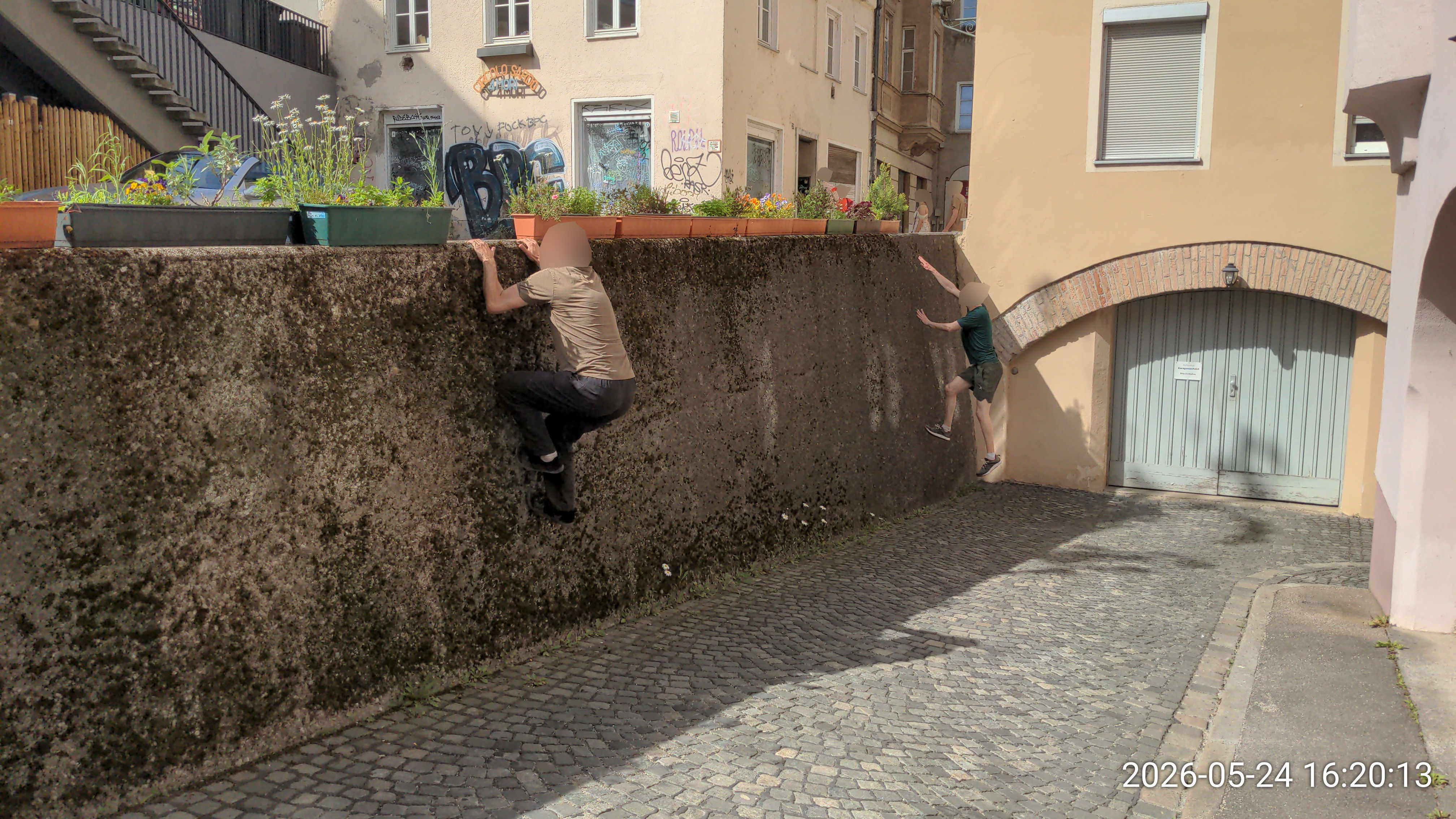
48.371398, 10.899813
⚠ Blumenkästen im Weg (verschiebbar)
- 💪
- Wallrun (klein), Wallpop, Drop (🦵), Vault, Katze (weit)
- 📍
- Wallrunmauer (grippy) (schief), Präzikanten, Vaultmauer, Steigung
Liliom Rohr Balance
4L2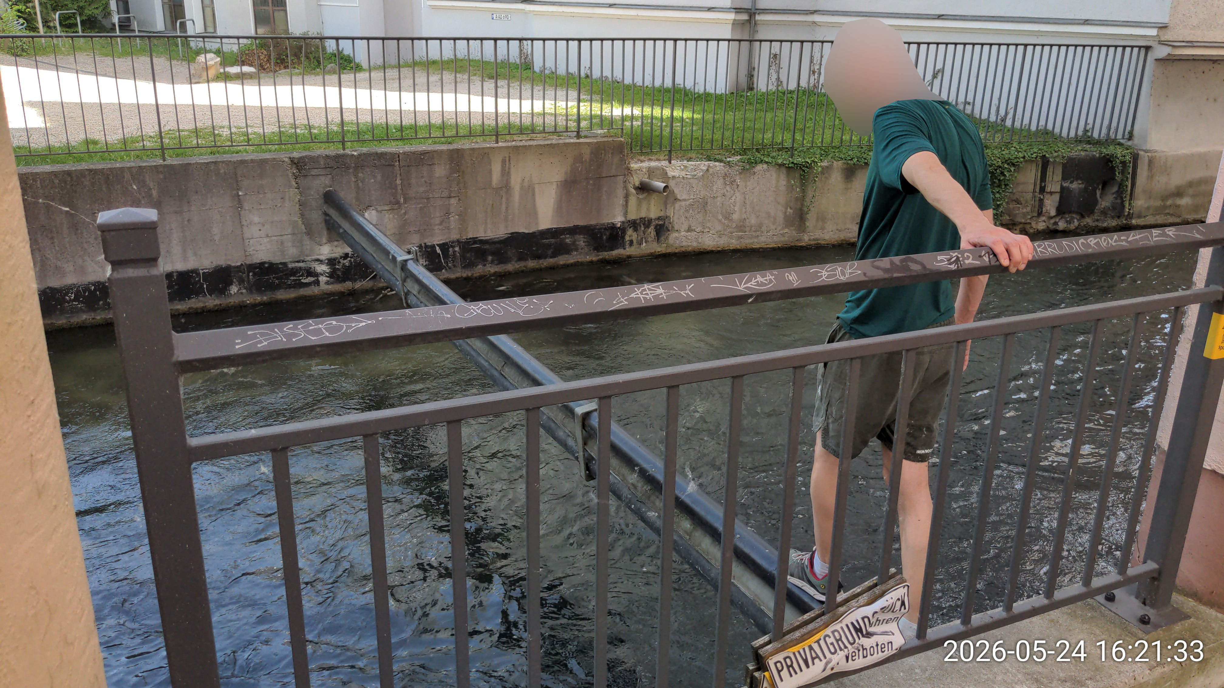
48.371370, 10.900031
- 💪
- Balance
- 📍
- Balancestange, Wasser, Geländer
- 🎁
- Balance übers Wasser
Liliom Kanal über Kanal
4L3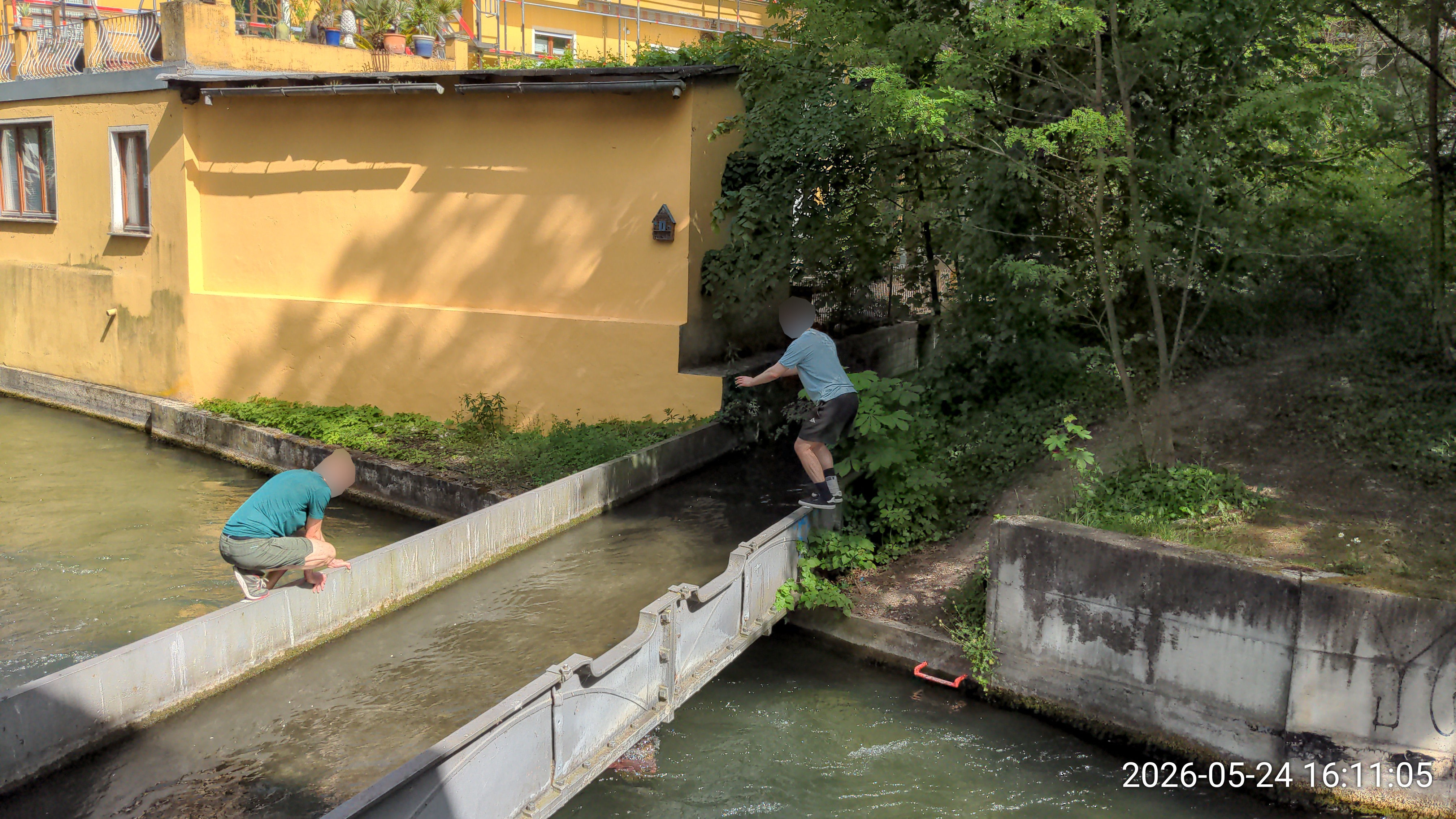
48.371951, 10.900674
⚠ Geländer auf halber Höhe sichtbar nicht stabil
- 💪
- Balance, Präzi (wack), Klettern, Rundgang
- 📍
- Wasser, Präzikanten (Mauer), Fassade
- 🎁
- Präzis auf Kanal über Kanal, Fassadenkletterei (beide Seiten)
Liliom Eingang
4L4
48.372204, 10.900953
⚠ Mauer am Wasser wackelt bei Bounce
- 💪
- Balance, Präzi (wack)
- 📍
- Präzikanten (Steine) (Mauer), Baum (schief)
Mauern beim Vincentinum
4V
48.373178, 10.901726
- 💪
- Präzi (running) (mittelhoch), Drop? (🦵) (🥵), Klettern?
- 📍
- Fassade, Vaultmauer, Präzikanten (Mauer)
- 🎁
- weiter running Pre zur Fassade
Schwedenstiege
4S
48.375179, 10.901337
- 💪
- Wallrun (hoch), Armsprung, Workout
- 📍
- Wallrunmauer, Fassade, Präzikanten (Stufen) (Mauer), Steigung
- 🎁
- Wallrun hoch auf Durchgangsbogen, Wallrun mit Kicker Tic Tac vom Baum
neben Leonhardsberg
4B
48.370210, 10.899170
- 💪
- Klettern, Armsprung (wack) (running), Präzi (wack), Schwinger (Pole), Vault, Katze (Doppel), Balance, Wallrun (hoch)
- 📍
- Fassade, Präzikanten (Stufen), Pole (schwingbar), Geländer (auf Wand) (dick) (wack), Block, Wallrunmauer (rutschig) (aufsteigend)
- 🎁
- Armsprünge und Schwinger an Ecke mit Pole, Sprünge zwischen Fassade und Zipfel+Geländer, Tic Tacs zu Stufen (an Wand oder Zipfel)
Café neben Leonhardsberg
4B1
48.370431, 10.898824
⚠ Wochenende-only
- 💪
- Armsprung, Vault, Wallrun (klein)
- 📍
- Fassade, Geländer
- 🎁
- Run übers Vordach nach oben
beim Dreizehn
4B2
48.369643, 10.899484
⚠ viele Betonpfosten locker (Autos reingefahren)
- 💪
- Armsprung (Kicker) (wack), Präzi (wack) (niedrig)
- 📍
- Fassade, Präzikanten (Stufen)
- 🎁
- Amrsprünge an Wändchen mit Metalldingern
5) Gögginger Hallenbad
Gögginger Hallenbad Eingangsbereich
5H
48.344541, 10.867184
- 💪
- Wallrun, Vault, Katze, Dynamo, Return (klein) (zu Armsprung)
- 📍
- Wallrunmauer, Vaultmauer (wack), Präzikanten (Stufen)
- 🎁
- Stufenchallenges, Halbmond-Dyno lernen, Breitarm-Hochhangeln
Hallenbad Turm
5H1
48.344631, 10.866664
- 💪
- Wallpop, Tic Tac, Armsprung (running), Return (weit) (running) (zu Armsprung)
- 📍
- Wallrunmauer
- 🎁
- (Anlauf-)Return zu Armsprung, Tic Tac Armsprung
Hallenbad hinteres Eck
5H2
48.344563, 10.866079
- 💪
- Vault, Wallrun, Katze
- 📍
- Wallrunmauer, Vaultmauer (hoch?), Container (klein)
- 🎁
- Katze mit Anlauf auf Mauer
Hallenbad Seiteneingang
5H3
48.344297, 10.867533
⚠ Geländer seit Umbau langweilig
- 💪
- Schwinger (Pole), Vault, Polio
- 📍
- Pole (schwingbar), Geländer
- 🎁
- Poleschwinger zu Polio / zurück zu Boden
Gögginger Hallenbad Spielplatz
5S
48.343443, 10.868965
⚠ Wochenende-only
- 💪
- Präzi (wack) (running) (weit) (wackelig), Vault
- 📍
- Spielplatz, Präzikanten, Vaultmauer, Tischtennisplatte
- 🎁
- Präzis auf federnd-wackeligen Stamm, Katze aufs Schwenktor
Katzenmauern beim Spielplatz
5S1
48.343846, 10.868303
⚠ Wochenende-only
- 💪
- Vault, Katze (Doppel), Präzi
- 📍
- Vaultmauer (niedrig)
- 🎁
- Niedrige Katze zur Mauer
Geländer beim Spielplatz
5S2
48.343208, 10.868968
⚠ Wochenende-only
- 💪
- Vault
- 📍
- Geländer (+1) (hoch)
- 🎁
- Hohe Vaults / Katze zu Stufen
Park hinterm Hallenbad
5P
48.343311, 10.866981
- 💪
- Präzi, Schwinger (Baum)
- 📍
- Präzikanten, Baum (schwingen)
- 🎁
- kleiner Baumschwinger zur Bank
Parkplätze im Gewerbegebiet
5G
48.342295, 10.863346
- 💪
- Präzi, Armsprung, Katze (Doppel), Wallrun (Überhang)
- 📍
- Präzikanten
Tiefgarageneinfahrt im Gewerbegebiet
5G1
48.341602, 10.863083
- 💪
- Präzi (weit)
- 📍
- Präzikanten, Tiefgarageneinfahrt
6) Pfersee & Stadtbergen
Sheridanpark Wasserspielplatz
6S
48.360011, 10.856938
⚠ Kinder
- 💪
- Rundgang, Präzi (eng) (wack) (weit) (running), Drop (🦵) (🦵🦵) (🥵) (🦵🦵🦵), Balance, Vault, Armsprung (wack), Klettern
- 📍
- Baumstammhölzer, Präzikanten (Felsen) (Steine), Vordach
- 🎁
- Rundgänge, 4 miese Präzis, Hurdle-Präzis
Sheridanpark Bäume
6S1
48.358498, 10.857005
- 💪
- Präzi (eng)
- 📍
- Präzikanten (Steine)
Sheridanpark Felsen
6S2
48.362415, 10.858470
⚠ Kinder
- 💪
- Armsprung (running), Klettern, Drop (🦵🦵) (🦵🦵🦵), Präzi
- 📍
- Präzikanten (Felsen)
altes Gebäde beim Sheridanpark
6S3
48.354909, 10.856327
- 💪
- Präzi (weit), Drop, Katze, Armsprung?
- 📍
- Präzikanten
Reds Kirchspot nahe Sheridan
6S4
48.366094, 10.856356
- 💪
- Präzi (weit), Armsprung?
- 📍
- Präzikanten, Geländer?
unter Bgm-Ackermann Brücke
6B
48.370490, 10.875995
⚠ Gleise sind aktiv, aber selten befahren
- 💪
- Balance, Strides, Präzi, Armsprung, Drop (Stange) (🦵) (🥵🥵)
- 📍
- Gleis, Geländer (hoch) (auf Wand)
- 🎁
- Stridemuster
Rampe Bgm-Ackermann-Brücke
6B1
48.371022, 10.876213
- 💪
- Vault, Balance, Armsprung, Drop (🦵🦵) (🥵)
- 📍
- Geländer
- 🎁
- Drop von Geländer zu Steinreihe
Wasserdurchlässe unter BgmA-Brücke
6B2
48.370506, 10.876870
- 💪
- Armsprung (runter)
- 🎁
- komischer Armsprung
Stahlträger bei Holzbachstr/Plärrer
6B3
48.372230, 10.879780
- 💪
- Präzi, Strides
- 📍
- Wasser
Herz Jesu Kirche Pfersee
6K
48.362891, 10.871838
- 💪
- Präzi (weit), Katze, Vault
- 📍
- Vaultmauer, Präzikanten
- 🎁
- Katzen auf/von Müllhäuschen
Katze neben Kirche
6K1
48.362612, 10.871009
- 💪
- Katze (Doppel), Präzi (niedrig)
- 📍
- Präzikanten (Mauer)
- 🎁
- Katze zur Mauer (dazwischen variabler Drop)
Zwischenbereich nahe See
6Z
48.371888, 10.862230
- 💪
- Präzi
- 📍
- Präzikanten (Steine)
Stadtbergen Sandkasten im Innenhof
6I
48.370618, 10.844498
- 💪
- Präzi (weit)
- 📍
- Präzikanten
Stadtbergen Tiefgarage neben Sandkasten im Innenhof
6I1
48.370582, 10.843986
⚠ leise sein
- 💪
- Strides, Präzi (running) (mittelhoch)
- 📍
- Präzikanten (Mauer)
kleine Kletterwand
6W
48.370231, 10.865344
- 💪
- Klettern
- 📍
- Spielplatz
7) City-Galerie
City-Galerie Steine
7S
48.364003, 10.907627
⚠ Verkehr (Fahrräder, Autos)
- 💪
- Präzi (weit) (wack), Rundgang, Balance, Strides
- 📍
- Präzikanten (Steine) (Stange), Balancestange
City-Galerie Tiefgarageneinfahrt
7T
48.364875, 10.905650
- 💪
- Armsprung (klein) (weit), Wallpop, Drop (🦵) (🥵), Return (weit) (zu Armsprung) (klein)
- 📍
- Tiefgarageneinfahrt, Präzikanten (Mauer), Balancestange
- 🎁
- Drop auf mittleres Mauerstück, Returns hoch und runter, super weiter Armsprung (aktuell durch Metallzacken blockiert)
VHS Eingang
7T1
48.365253, 10.905427
- 💪
- Vault, Wallrun (klein), Wallpop, Präzi
- 📍
- Vaultmauer, Präzikanten (Stufen), Wallrunmauer
kleiner Präzi auf Metallbalken
7T2
48.365416, 10.905425
- 💪
- Präzi (wack) (mittelhoch), Vault, Armsprung
- 📍
- Wasser, Präzikanten, Geländer (auf Wand)
- 🎁
- Präzi auf Metallbalken über Wasser
VHS Ecke
7T3
48.365591, 10.904977
- 💪
- Katze (zu Armsprung), Präzi
- 📍
- Wallrunmauer, Präzikanten (Stufen)
- 🎁
- schiefe Katze zu Armsprung am Mauereck
City-Galerie Brücke
7B
48.366259, 10.904590
⚠ Verkehr (alles, v.a. Fuß)
- 💪
- Vault, Präzi (wack) (hoch) (niedrig) (weit)
- 📍
- Vaultmauer, Präzikanten (Mauer), Wasser
- 🎁
- Präzi auf Brückengeländer, Präzi auf grünes Metalldingens
City-Galerie Hinterhof
7H
48.367872, 10.905688
⚠ leise sein
- 💪
- Präzi (hoch) (running) (niedrig), Strides, Drop (🦵🦵) (🥵), Klettern, Descend
- 📍
- Präzikanten (Holz) (Mauer), Vaultmauer, Spielplatz, Pole?, Baum
- 🎁
- Präzis und Strides oben auf den Holzbalken, im Kreisrand vom Sandkasten rennen
City-Galerie Spielplatz
7P
48.364600, 10.904982
⚠ Kinder
- 💪
- Klettern
- 📍
- Spielplatz, Schaukel
- 🎁
- Bens Backflip von Schaukelgerüst runter
Wasserrad nahe City-Galerie
7W
48.363911, 10.902997
⚠ eingeschränkter Zugang
- 💪
- Klettern, Balance, Descend
- 📍
- Wasser, Präzikanten (Holz)
- 🎁
- im Wasserrad nicht verunglücken
Holbeinplatz
7G
48.366895, 10.901458
⚠ Verkehr (viele abhängende Leute)
- 💪
- Balance, Präzi (running) (mittelhoch), Vault
- 📍
- Wasser, Geländer, Bank, Präzikanten
- 🎁
- running Pre von Bank über Kanal und die Geländer
8) Textilmuseum
Textilmuseum (Schneise)
8A
48.361738, 10.913410
⚠ leise sein
- 📍
- Fassade, Präzikanten (Mauer) (Stufen), Geländer (auf Wand) (wack)
Wasserkraftwerk
8W
48.363911, 10.914702
⚠ eingeschränkter Zugang
- 💪
- Präzi (mittelhoch) (wack), Armsprung (klein), Vault
- 📍
- Wasser, Fassade, Präzikanten (Stange) (Mauer), Geländer (auf Wand) (wack)
Strides bei Gärtnerstraße X Wolframstr
8G
48.360115, 10.910671
⚠ Verkehr (Autos)
- 💪
- Strides, Präzi (weit) (niedrig)
- 📍
- Präzikanten (Mauer), Spielplatz
- 🎁
- viele knackige Strides am Rand
Running Pre beim Kanal
8R
48.362934, 10.914764
⚠ eingeschränkter Zugang
- 💪
- Präzi (running)
- 📍
- Wasser, Gap, Präzikanten
- 🎁
- Running Pre übers Wasser, kleiner Pre übers Wasser
Schafe
8S
48.363909, 10.911932
- 💪
- Präzi, Tic Tac?
- 📍
- Präzikanten (Steine)
Spielplatz neben Schafen
8S1
48.364308, 10.912524
- 💪
- Präzi?, Vault?
- 📍
- Präzikanten (Steine) (Stange?), Geländer?, Schwingerstange?, Pole? (schwingbar?)
Textilmuseum Metalltreppe beim Parkplatz
8T
48.361851, 10.912138
- 💪
- Armsprung (weit), Drop, Vault, Präzi (mittelhoch), Return
- 📍
- Stufen mit Wand, Geländer (auf Wand) (wack), Präzikanten (Mauer), Vaultmauer (hoch?)
9) Univiertel
Graffiti-Unterführung
9G
48.336601, 10.907345
⚠ Verkehr (Fahrräder)
- 💪
- Wallrun (klein) (hoch), Vault, Katze (Stange)
- 📍
- Wallrunmauer (aufsteigend) (rutschig), Geländer (dick) (auf Wand), Präzikanten (Stufen), Steigung
Garageneinfahrt bei Graffiti-Unterführung
9G1
48.336652, 10.906865
⚠ leise sein
- 💪
- Armsprung, Drop (🦵🦵) (🥵)
- 📍
- Wallrunmauer, Präzikanten (Mauer)
- 🎁
- Armsprung und Drop über kleine Gap
Innenhof
9H
48.335347, 10.906149
- 💪
- Vault, Präzi?
- 📍
- Geländer, Präzikanten (Mauer?)
Parkplatz neben Innenhof
9H1
48.335015, 10.906149
⚠ leise sein
- 💪
- Wallpop, Präzi?, Vault?
- 📍
- Wallrunmauer, Präzikanten (Stufen)
Bukowina-Institut Hochhaus
9B
48.337799, 10.900355
- 💪
- Schwinger (Baum), Präzi, Vault
- 📍
- Baum (schwingen), Bank, Vaultmauer (hoch), Präzikanten, Geländer (nahe Wand)
Bukowina Hochhaus Seite
9B1
48.337963, 10.900857
⚠ leise sein
- 💪
- Dynamo, Armsprung
- 📍
- Stufen mit Wand
Uni T-Gebäude
9T
48.332382, 10.897035
⚠ Wochenende-only
- 💪
- Katze (wack) (Stange), Vault, Balance
- 📍
- Geländer (auf Wand), Präzikanten (Stufen)
- 🎁
- Katze zum Stahlträger
10) Hochschule & Rotes Tor Park
Hochschule Kanalbrücke
10H
48.358709, 10.907874
⚠ Verkehr (parkende Autos)
- 💪
- Präzi (weit) (wack) (eng) (niedrig) (mittelhoch), Wallrun (klein), Vault, Wallpop, Armsprung (running) (runter), Drop (🥵) (🦵🦵) (🥵🥵), Return? (weit) (zu Armsprung), Katze (wack) (zu Armsprung)
- 📍
- Präzikanten (Stange) (Mauer), Wasser, Wallrunmauer (rutschig) (aufsteigend), Geländer (dick) (auf Wand), Tiefgarageneinfahrt, Vaultmauer (wack)
Hochschule Parkdeck
10H1
48.358013, 10.907396
- 💪
- Klettern, Präzi, Strides, Armsprung, Drop (🦵🦵🦵) (🥵)
- 📍
- Geländer (auf Wand) (wack) (hoch?), Präzikanten (Steine) (Stufen), Tischtennisplatte, Bank
Kanal an Haltestelle Hochschule
10H2
48.359045, 10.906012
- 💪
- Drop (🦵🦵) (🥵🥵), Katze, Vault
- 📍
- Wasser, Geländer (hoch) (dick) (auf Wand), Präzikanten (Mauer)
- 🎁
- kranke Katze über Kanal
Hochschule Tiefgarageneinfahrt
10T
48.358258, 10.905749
- 💪
- Vault, Wallrun (klein), Katze, Wallpop?, Präzi?
- 📍
- Tiefgarageneinfahrt, Vaultmauer, Wallrunmauer, Präzikanten?
Präzis und Abgang bei Tiefgarageneinfahrt
10T1
48.358124, 10.906232
- 💪
- Präzi (wack), Armsprung (wack), Vault
- 📍
- Geländer (wack) (auf Wand), Präzikanten (Stange)
- 🎁
- komische Präzis etc bei rundem Abgang
Spielplatz Lummerland
10S
48.360797, 10.905100
⚠ Kinder
- 💪
- Armsprung (Kicker), Klettern, Balance, Präzi (wack) (eng) (mittelhoch), Drop, Vault
- 📍
- Spielplatz, Präzikanten (Holz) (Mauer), Bank, Pole
- 🎁
- Kicker-Armsprünge an Wände
Rotes Tor Park Brückchen und Aufgang
10R
48.359922, 10.904934
- 💪
- Vault, Wallrun (klein), Wallpop?, Drop (🦵) (🥵), Katze, Präzi
- 📍
- Wallrunmauer (grippy) (wack), Geländer (auf Wand) (wack), Wasser, Präzikanten (Stufen) (Baum) (Stange?), Fassade, Steigung, Bank?
- 🎁
- Katze Drop zu Bäumen
Rotes Tor Park Ecke neben Freilichtbühne
10R1
48.359290, 10.903445
- 💪
- Klettern, Armsprung, Return?, Präzi, Wallrun? (hoch?)
- 📍
- Präzikanten (Stufen) (Mauer?), Fassade, Wallrunmauer? (grippy), Wasser?
- 🎁
- wackes Zeug mit Wänden in der Ecke
Ausgang nahe Puppenkiste
10R2
48.359997, 10.903333
- 💪
- Armsprung, Return (zu Stange), Vault, Präzi
- 📍
- Wasser, Geländer (auf Wand), Präzikanten (Mauer)
- 🎁
- Armsprung (und Return?) über Wasser
11) Haunstetten
Schwingerbäume bei den Steinen
11S1
48.321004, 10.891657
⚠ parkende Autos blockieren
- 💪
- Schwinger (Baum), Präzi
- 📍
- Baum (schwingen), Präzikanten
- 🎁
- Bamschwingerklassiker
Armsprungstufen hinterm POCO
11P1
48.321025, 10.888857
⚠ Sonntag-only
- 💪
- Armsprung (klein), Drop
- 📍
- Stufen mit Wand, Geländer (auf Wand), Präzikanten (Stufen)
Bachbrückchen neben Feuerwehr
11B
48.308382, 10.912157
- 💪
- Vault, Armsprung, Präzi
- 📍
- Geländer (+1), Vaultmauer, Präzikanten, Bank?, Wasser?
Spielplatz Haunstetten
11K
48.312178, 10.910692
⚠ Kinder
- 💪
- Vault, Balance, Präzi?
- 📍
- Spielplatz, Geländer (+1), Bank?
Dachspot
11D
48.311313, 10.912264
⚠ leise sein
- 💪
- Präzi (weit) (niedrig)
- 📍
- Präzikanten (Mauer)
12) Hochzoll & Eiskanal
Gebäude an der Kanustrecke
12K
48.349952, 10.936707
- 💪
- Präzi (wack), Drop?, Katze (Doppel), Rundgang?
- 📍
- Präzikanten (Mauer), Vaultmauer (niedrig), Fassade
Innenhof mit Stangenpre und Rampe neben Spielplatz
12H
48.339822, 10.947232
⚠ leise sein
- 💪
- Präzi (running) (niedrig), Vault
- 📍
- Vaultmauer, Geländer (auf Wand), Präzikanten (Mauer), Schaukel
- 🎁
- Running Pre zum Geländer
Garagengap
12G
48.344755, 10.947479
⚠ überwuchert
- 💪
- Drop (🦵🦵)
- 📍
- Gap, Wallrunmauer
- 🎁
- Running Drop über die Garagengap
womöglich hier ranzige Schwingerstange mit Hof daneben
12S
48.343752, 10.942453
recht solider Spot noch
12B
48.356677, 10.946175
Ranzige Returns bzw ultra mini roofgap
12R
48.340887, 10.944185
der andere Ranzspot gleich daneben
12R1
48.340589, 10.944979
bei niedrigen wasser geht hier vllt was, hätt bock mal vorbeizuschaun
12L
48.346470, 10.937201
⚠ nur bei niedrigem Wasserstand
- 💪
- Präzi, Strides?
- 📍
- Präzikanten (Steine), Wasser
Hochablass (unten)
12A
48.344581, 10.935739
- 💪
- Präzi (hoch) (weit?), Strides?
- 📍
- Präzikanten (Mauer), Wasser
Hochablass (oben)
12A1
48.344463, 10.935787
⚠ Höhe (Lebensgefahr)
- 💪
- Präzi (zu hoch) (weit?), Strides?
- 📍
- Präzikanten (Mauer), Wasser
- 🎁
- nicht sterben
13) Friedberg
4FCircle Spielplatz
13C
48.356908, 10.981967
- 💪
- Präzi (wack) (weit), Schwinger (Stange), Katze
- 📍
- Präzikanten (Holz), Spielplatz, Schwingerstange, Pole, Bank
- 🎁
- Sandkastenpräzis alle Richtungen, Katze von Bank zu Sandkasten Plyo rüber
Steine beim 4FCircle
13C1
48.356878, 10.982517
- 💪
- Präzi (weit) (running)
- 📍
- Präzikanten (Felsen), Tischtennisplatte?
Schuleingang neben 4FCirlce
13C2
48.357044, 10.982908
⚠ Wochenende-only
- 💪
- Präzi (wack), Armsprung (wack), Return
- 📍
- Präzikanten (Stufen)
- 🎁
- Minipräzi auf Kante unter Aufgangmauer neben Treppe
Treppenaufgang neben 4FCircle
13C3
48.357146, 10.982230
⚠ Wochenende-only
- 💪
- Armsprung (running), Tic Tac, Dynamo, Vault, Drop
- 📍
- Präzikanten (Stufen), Geländer (auf Wand)
Kirche (vorne)
13K
48.355169, 10.979883
- 💪
- Präzi (wack), Armsprung (klein) (running), Tic Tac, Klettern, Katze
- 📍
- Baum (klettern), Fassade, Präzikanten (Baum) (Stufen), Vaultmauer (hoch)
Kirche hinten
13B
48.355531, 10.979875
- 💪
- Präzi, Klettern, Vault, Armsprung (klein), Balance
- 📍
- Fassade, Präzikanten (Stufen), Geländer (auf Wand)
- 🎁
- Spielereien im engen Gang, Run vorbei am Kirchtor
0) Sonstige Spots
Wertachbrücke Spielplatz
0W
48.376808, 10.879270
⚠ Kinder
- 💪
- Präzi (weit) (wack) (niedrig) (mittelhoch) (running), Drop (🦵) (🥵), Armsprung (weit) (klein) (runter) (wack), Balance, Return (klein) (zu Armsprung), Katze (zu Armsprung)
- 📍
- Präzikanten (Steine) (Mauer) (Holz), Kletterpyramide, Schaukel, Spielplatz
- 🎁
- Armsprung runter, Präzi und Drop auf Kletterpyramide, Armsprung von Kletterpyramide, Präzis bei Holz neben Schaukel
Free.Ground Academy
0FG
48.449685, 10.149044
⚠ Öffnungszeiten & Eintrittskosten
- 💪
- Schwinger (Stange), Armsprung, Katze, Präzi (mittelhoch)
- 📍
- Schwingerstange, Präzikanten (Stange) (verschiebbar)
- 🎁
- Walltramp, krasse Schwinger(combos), Ninja-Kram
Alter Brunnen beim Plärrer
0P
48.374206, 10.883728
⚠ nasses Laub
- 💪
- Präzi (weit) (running), Drop (🦵), Armsprung (wack), Return, Katze (weit), Rundgang?
- 📍
- Präzikanten (Mauer), Bank
- 🎁
- Präzis und Strides mit kleinen Statuen, schön variierend weite Präzis mit Bänken
Studentenwohnheim am Lech
0L
48.375060, 10.912203
⚠ Baustelle
- 💪
- Schwinger (Stange), Präzi, Armsprung (runter), Wallrun (hoch), Wallpop, Vault?, Katze?, Drop? (🦵) (🥵)
- 📍
- Schwingerstange, Präzikanten (Stufen) (Mauer), Wallrunmauer, Vaultmauer
- 🎁
- Schwinger mit schwierigen Griffen, Armsprung an engere Mauer
Modepark beim Studentenwohnheim
0L1
48.374131, 10.910333
⚠ Verkehr (Autoparkplätze, werktags)
- 💪
- Präzi (hoch) (mittelhoch) (niedrig), Wallrun (hoch), Vault, Armsprung (runter), Return (kurz) (zu Armsprung)
- 📍
- Präzikanten (Mauer) (Stange) (Stufen), Wallrunmauer (rutschig), Geländer (hoch) (wack), Tiefgarageneinfahrt
- 🎁
- Präzi auf Einscheißmauer, Präzi zwischen Geländern
Grieslepark Hölzer
0G
48.381582, 10.908244
⚠ Kinder
- 💪
- Präzi (wack) (weit) (mittelhoch) (hoch), Drop (🦵) (🦵🦵) (🥵), Balance, Klettern
- 📍
- Baumstammhölzer
- 🎁
- Präzis auf Stammenden
Grieslepark Calisthenics
0G1
48.382448, 10.907570
- 💪
- Workout, Schwinger (Stange), Präzi?, Drop?, Balance, Return?
- 📍
- Schwingerstange, Präzikanten (Stange?), Bank?, Geländer?, Pole (schwingbar?)
Holzstämme nahe Uniklinik
0H
48.382611, 10.848028
- 💪
- Präzi (wack) (weit) (niedrig), Balance, Katze?
- 📍
- Baumstammhölzer
Spielplatz nahe Holzsstämme nahe UK
0H1
48.382163, 10.847738
- 💪
- Katze (wack), Polio
- 📍
- Spielplatz, Schaukel, Präzikanten?, Bank?
- 🎁
- Katze über Schaukelkorb
Bunter Quaderhaufen nahe Uniklinik
0H2
48.382511, 10.847022
- 💪
- Präzi, Drop
- 📍
- Präzikanten
zwischen OBI und real
0R
48.364607, 10.927046
- 💪
- Rundgang, Klettern, Balance, Präzi
- 📍
- Fassade, Präzikanten, Geländer?
- 🎁
- in Mauernlücke eingespannt hochklettern
Katze beim Sport Outlet hinterm OBI
0R1
48.365399, 10.927038
- 💪
- Katze (Doppel)
- 📍
- Vaultmauer, Präzikanten (Mauer)
Mauern beim Sport Outlet hinterm OBI
0R2
48.365358, 10.926290
- 💪
- Präzi (niedrig), Vault?, Katze?, Return?
- 📍
- Vaultmauer?, Geländer?, Präzikanten (Mauer) (Stufen)
Holzspielplatz im Bismarckviertel
0B
48.357784, 10.895310
- 💪
- Präzi (wack) (weit) (niedrig), Balance
- 📍
- Baumstammhölzer, Spielplatz, Präzikanten?
Spielplatz nahe Senkelbach und Knochenturmmauer
0S
48.376378, 10.888256
⚠ Kinder
- 💪
- Präzi (wack), Armsprung?, Wallrun (klein) (hoch), Vault
- 📍
- Spielplatz, Schaukel?, Tischtennisplatte, Bank, Wallrunmauer (aufsteigend), Geländer (auf Wand)
Präzis/Strides des Todes bei TWS
0T
48.357732, 10.910711
⚠ Todesgefahr
- 💪
- Präzi (zu hoch), Klettern
- 📍
- Präzikanten (Mauer), Fassade
- 🎁
- nicht sterben
Klosterlechfeld Parkourpark
0KP
48.157242, 10.834934
⚠ Kinder
- 💪
- Schwinger (Stange) (Pole), Polio, Vault, Präzi (wack) (weit) (running) (niedrig) (mittelhoch), Armsprung (runter) (klein), Return (zu Armsprung), Drop (🦵🦵) (🥵) (Stange), Katze (Stange) (zu Armsprung), Balance, Klettern
- 📍
- Schwingerstange, Pole (schwingbar), Wallrunmauer, Geländer (hoch) (dick), Baumstammhölzer, Vaultmauer, Präzikanten (Mauer) (Stange) (Steine)
- 🎁
- Poleschwinger 450 zu Polio, Katze zu kleinem Armsprung
Welden Parkourpark
0WP
48.465038, 10.654617
- 💪
- Schwinger (Stange), Präzi (weit) (niedrig) (mittelhoch), Armsprung (runter) (klein), Drop (Stange), Katze?, Return?, Polio?, Vault?, Balance
- 📍
- Schwingerstange, Wallrunmauer, Geländer, Baumstammhölzer